Area Overview for PE11 2HQ
Photos of PE11 2HQ
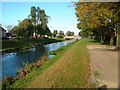
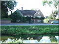
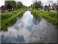
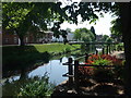
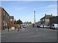
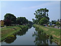
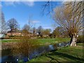
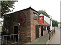


54 photos from this area
Area Information
Key information about the PE11 2HQ including its size, population, and administrative classification.
- Area Type
- Postcode
- Area Size
- 1.3 hectares
- Population
- 1873
- Population Density
- 287 people/km²
House Prices in PE11 2HQ
13
Properties
£123,444
Average Sold Price
£70,000
Lowest Price
£162,500
Highest Price
Showing 13 properties
| Address | Type | Beds | Baths | Last Sale Price | Last Sale Date | |
|---|---|---|---|---|---|---|
| 42 Holbeach Road, Spalding, PE11 2HQ | house | - | - | £162,500 | Mar 2022 | |
| 40 Holbeach Road, Spalding, PE11 2HQ | house | - | - | £162,500 | Feb 2022 | |
| 38 Holbeach Road, Spalding, PE11 2HQ | Detached | 2 | 1 | £162,500 | Dec 2021 | |
| 36 Holbeach Road, Spalding, PE11 2HQ | house | - | - | £162,500 | Dec 2021 | |
| 32A Holbeach Road, Spalding, PE11 2HQ | Semi-detached | 3 | 1 | £106,000 | Jun 2019 | |
| Ivy Cottage, 32 Holbeach Road, Spalding, PE11 2HQ | Terraced | 2 | - | £75,000 | Dec 2011 | |
| 34A Holbeach Road, Spalding, PE11 2HQ | house | - | - | £108,000 | Jul 2008 | |
| 44 Holbeach Road, Spalding, PE11 2HQ | Semi-detached | - | - | £102,000 | Oct 2007 | |
| Holly Cottage, 34 Holbeach Road, Spalding, PE11 2HQ | house | - | - | £70,000 | Apr 2003 | |
| 42A Holbeach Road, Spalding, PE11 2HQ | Semi-detached | 2 | 1 | - | - |
Page 1 of 2
Energy Efficiency in PE11 2HQ
Amenities
Schools
| Rank | School | Type | Entry gender | Ages |
|---|
Explore more schools in this area
Go to Schools tabDemographics
Household Size
Family (3-5 people)
most common
Accommodation Type
Houses
most common
Tenure
45
majority
Ethnic Group
White
most common
Religion
N/A
most common
Household Composition
N/A
most common
Age
47
median
Adults (30-64 years)
most common
Household Deprivation
N/A
with no deprivation
NS-SEC
16
in Lower managerial occupations
Explore more demographic insights in this area
Go to Demographics tabPlanning
Planning Constraints
- Flood RiskPremium
- Ramsar Wetland SitesPremium
- Area of Outstanding Natural BeautyPremium
- Protected Nature ReservePremium
- Protected WoodlandPremium