Area Overview for PE11 1UG
Photos of PE11 1UG
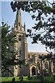
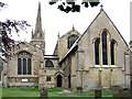
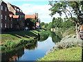
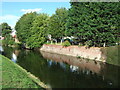

100 photos from this area
Area Information
Key information about the PE11 1UG including its size, population, and administrative classification.
- Area Type
- Postcode
- Area Size
- 2780 m²
- Population
- 1381
- Population Density
- 4071 people/km²
House Prices in PE11 1UG
13
Properties
£79,269
Average Sold Price
£38,000
Lowest Price
£150,000
Highest Price
Showing 13 properties
| Address | Type | Beds | Baths | Last Sale Price | Last Sale Date | |
|---|---|---|---|---|---|---|
| 11, Abbey House, High Street, Spalding, PE11 1UG | Flat | - | - | £78,000 | Oct 2023 | |
| 9, Abbey House, High Street, Spalding, PE11 1UG | Flat | - | - | £86,000 | Dec 2022 | |
| 5, Abbey House, High Street, Spalding, PE11 1UG | house | - | - | £150,000 | Dec 2022 | |
| 6, Abbey House, High Street, Spalding, PE11 1UG | Flat | - | - | £97,500 | Dec 2021 | |
| 12, Abbey House, High Street, Spalding, PE11 1UG | Flat | - | - | £65,000 | Jan 2015 | |
| 2, Abbey House, High Street, Spalding, PE11 1UG | Flat | - | - | £75,000 | Mar 2013 | |
| 13, Abbey House, High Street, Spalding, PE11 1UG | Flat | - | - | £87,500 | Nov 2012 | |
| 1, Abbey House, High Street, Spalding, PE11 1UG | Flat | - | - | £85,000 | Sep 2009 | |
| 7, Abbey House, High Street, Spalding, PE11 1UG | Flat | - | - | £45,000 | Jan 2007 | |
| 8, Abbey House, High Street, Spalding, PE11 1UG | Flat | - | - | £90,500 | Mar 2005 |
Page 1 of 2
Energy Efficiency in PE11 1UG
Amenities
Schools
| Rank | School | Type | Entry gender | Ages |
|---|
Explore more schools in this area
Go to Schools tabDemographics
Household Size
Two person
most common
Accommodation Type
Houses
most common
Tenure
63
majority
Ethnic Group
White
most common
Religion
N/A
most common
Household Composition
N/A
most common
Age
47
median
Adults (30-64 years)
most common
Household Deprivation
N/A
with no deprivation
NS-SEC
27
in Lower managerial occupations
Explore more demographic insights in this area
Go to Demographics tabPlanning
Planning Constraints
- Flood RiskPremium
- Ramsar Wetland SitesPremium
- Area of Outstanding Natural BeautyPremium
- Protected Nature ReservePremium
- Protected WoodlandPremium