Area Overview for PE11 1QL
Photos of PE11 1QL
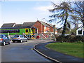
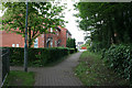
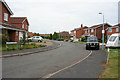
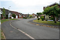
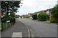
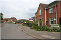
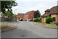
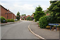
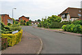
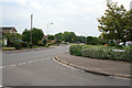
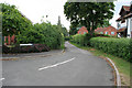
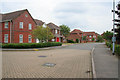
27 photos from this area
Area Information
Key information about the PE11 1QL including its size, population, and administrative classification.
- Area Type
- Postcode
- Area Size
- 3.2 hectares
- Population
- 1369
- Population Density
- 761 people/km²
House Prices in PE11 1QL
18
Properties
£182,000
Average Sold Price
£72,000
Lowest Price
£282,000
Highest Price
Showing 18 properties
| Address | Type | Beds | Baths | Last Sale Price | Last Sale Date | |
|---|---|---|---|---|---|---|
| 102 Pinchbeck Road, Spalding, PE11 1QL | Bungalow | 4 | - | £277,500 | Feb 2021 | |
| 105 Pinchbeck Road, Spalding, PE11 1QL | house | - | - | £240,000 | Aug 2018 | |
| 107 Pinchbeck Road, Spalding, PE11 1QL | Detached | 5 | 2 | £282,000 | Sep 2016 | |
| 109A Pinchbeck Road, Spalding, PE11 1QL | Detached | 3 | 1 | £182,500 | Mar 2016 | |
| 112 Pinchbeck Road, Spalding, PE11 1QL | house | - | - | £160,000 | Dec 2012 | |
| 109 Pinchbeck Road, Spalding, PE11 1QL | Detached | - | - | £125,000 | Oct 2012 | |
| 111 Pinchbeck Road, Spalding, PE11 1QL | Detached | - | - | £212,500 | Oct 2005 | |
| 96 Pinchbeck Road, Spalding, PE11 1QL | Detached | 4 | 2 | £86,500 | Oct 1999 | |
| 108 Pinchbeck Road, Spalding, PE11 1QL | Semi-detached | - | - | £72,000 | Sep 1996 | |
| 99 Pinchbeck Road, Spalding, PE11 1QL | Detached | 4 | 2 | - | - |
Page 1 of 2
Energy Efficiency in PE11 1QL
Amenities
Schools
| Rank | School | Type | Entry gender | Ages |
|---|
Explore more schools in this area
Go to Schools tabDemographics
Household Size
Two person
most common
Accommodation Type
Houses
most common
Tenure
81
majority
Ethnic Group
White
most common
Religion
N/A
most common
Household Composition
N/A
most common
Age
47
median
Adults (30-64 years)
most common
Household Deprivation
N/A
with no deprivation
NS-SEC
30
in Lower managerial occupations
Explore more demographic insights in this area
Go to Demographics tabPlanning
Planning Constraints
- Flood RiskPremium
- Ramsar Wetland SitesPremium
- Area of Outstanding Natural BeautyPremium
- Protected Nature ReservePremium
- Protected WoodlandPremium