Area Overview for PE10 9WA
Photos of PE10 9WA
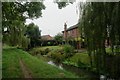
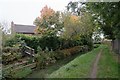
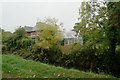
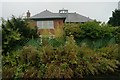
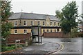


100 photos from this area
Area Information
Key information about the PE10 9WA including its size, population, and administrative classification.
- Area Type
- Postcode
- Area Size
- 1.1 hectares
- Population
- 1310
- Population Density
- 1357 people/km²
House Prices in PE10 9WA
20
Properties
£164,085
Average Sold Price
£58,950
Lowest Price
£377,500
Highest Price
Showing 20 properties
| Address | Type | Beds | Baths | Last Sale Price | Last Sale Date | |
|---|---|---|---|---|---|---|
| 5 Coleridge Place, Bourne, PE10 9WA | Detached | 5 | 2 | £377,500 | Jun 2025 | |
| 7 Coleridge Place, Bourne, PE10 9WA | Detached | 4 | 2 | £270,000 | May 2018 | |
| 15 Coleridge Place, Bourne, PE10 9WA | Detached | 4 | 2 | £290,000 | Mar 2017 | |
| 17 Coleridge Place, Bourne, PE10 9WA | Detached | - | - | £233,000 | Apr 2008 | |
| 21 Coleridge Place, Bourne, PE10 9WA | Detached | - | - | £235,000 | May 2007 | |
| 9 Coleridge Place, Bourne, PE10 9WA | Detached | - | - | £191,000 | Mar 2007 | |
| 14 Coleridge Place, Bourne, PE10 9WA | Detached | - | - | £205,000 | Jun 2006 | |
| 18 Coleridge Place, Bourne, PE10 9WA | Detached | - | - | £200,000 | May 2006 | |
| 3 Coleridge Place, Bourne, PE10 9WA | Detached | - | - | £175,000 | Nov 2005 | |
| 4 Coleridge Place, Bourne, PE10 9WA | Semi-detached | - | - | £137,500 | Jul 2005 |
Page 1 of 2
Energy Efficiency in PE10 9WA
Amenities
Schools
| Rank | School | Type | Entry gender | Ages |
|---|
Explore more schools in this area
Go to Schools tabDemographics
Household Size
Family (3-5 people)
most common
Accommodation Type
Houses
most common
Tenure
69
majority
Ethnic Group
White
most common
Religion
N/A
most common
Household Composition
N/A
most common
Age
47
median
Adults (30-64 years)
most common
Household Deprivation
N/A
with no deprivation
NS-SEC
35
in Lower managerial occupations
Explore more demographic insights in this area
Go to Demographics tabPlanning
Planning Constraints
- Flood RiskPremium
- Ramsar Wetland SitesPremium
- Area of Outstanding Natural BeautyPremium
- Protected Nature ReservePremium
- Protected WoodlandPremium