Area Overview for PE10 2AL
Photos of PE10 2AL

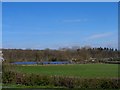


100 photos from this area
Area Information
Key information about the PE10 2AL including its size, population, and administrative classification.
- Area Type
- Postcode
- Area Size
- 1.4 hectares
- Population
- 1439
- Population Density
- 771 people/km²
House Prices in PE10 2AL
19
Properties
£279,730
Average Sold Price
£225,000
Lowest Price
£399,950
Highest Price
Showing 19 properties
| Address | Type | Beds | Baths | Last Sale Price | Last Sale Date | |
|---|---|---|---|---|---|---|
| 6 Fakenham Green, Bourne, PE10 2AL | house | - | - | £367,950 | Mar 2024 | |
| 7 Fakenham Green, Bourne, PE10 2AL | house | - | - | £225,000 | Sep 2023 | |
| 5 Fakenham Green, Bourne, PE10 2AL | house | - | - | £225,000 | Sep 2023 | |
| 9 Fakenham Green, Bourne, PE10 2AL | house | - | - | £248,982 | Mar 2023 | |
| 4 Fakenham Green, Bourne, PE10 2AL | house | - | - | £244,256 | Mar 2023 | |
| 8 Fakenham Green, Bourne, PE10 2AL | house | - | - | £246,971 | Mar 2023 | |
| 10 Fakenham Green, Bourne, PE10 2AL | house | - | - | £399,950 | Jan 2023 | |
| 1 Fakenham Green, Bourne, PE10 2AL | Detached | 3 | 2 | - | - | |
| 12 Fakenham Green, Bourne, PE10 2AL | house | - | - | - | - | |
| 3 Fakenham Green, Bourne, PE10 2AL | house | - | - | - | - |
Page 1 of 2
Energy Efficiency in PE10 2AL
Amenities
Schools
| Rank | School | Type | Entry gender | Ages |
|---|
Explore more schools in this area
Go to Schools tabDemographics
Household Size
Family (3-5 people)
most common
Accommodation Type
Houses
most common
Tenure
73
majority
Ethnic Group
White
most common
Religion
N/A
most common
Household Composition
N/A
most common
Age
47
median
Adults (30-64 years)
most common
Household Deprivation
N/A
with no deprivation
NS-SEC
43
in Lower managerial occupations
Explore more demographic insights in this area
Go to Demographics tabPlanning
Planning Constraints
- Flood RiskPremium
- Ramsar Wetland SitesPremium
- Area of Outstanding Natural BeautyPremium
- Protected Nature ReservePremium
- Protected WoodlandPremium