Area Overview for OX17 3RX
Photos of OX17 3RX
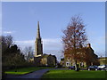
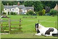
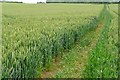
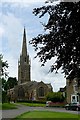
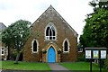
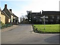
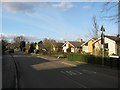

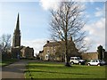
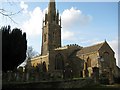
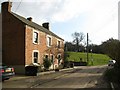
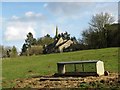
100 photos from this area
Area Information
Key information about the OX17 3RX including its size, population, and administrative classification.
- Area Type
- Postcode
- Area Size
- 13.0 hectares
- Population
- 2307
- Population Density
- 139 people/km²
House Prices in OX17 3RX
34
Properties
£272,618
Average Sold Price
£9,000
Lowest Price
£525,000
Highest Price
Showing 34 properties
| Address | Type | Beds | Baths | Last Sale Price | Last Sale Date | |
|---|---|---|---|---|---|---|
| 68 Banbury Lane, Kings Sutton, OX17 3RX | Terraced | 2 | 1 | £280,000 | Sep 2025 | |
| 58 Banbury Lane, Kings Sutton, OX17 3RX | house | - | - | £525,000 | Jul 2024 | |
| 64 Banbury Lane, Kings Sutton, OX17 3RX | Terraced | 3 | 1 | £401,250 | May 2023 | |
| 50 Banbury Lane, Kings Sutton, OX17 3RX | house | - | - | £442,500 | Oct 2020 | |
| 62 Banbury Lane, Kings Sutton, OX17 3RX | Terraced | 3 | - | £330,000 | Sep 2018 | |
| 36 Banbury Lane, Kings Sutton, OX17 3RX | Detached | 4 | - | £272,000 | Jul 2016 | |
| 40 Banbury Lane, Kings Sutton, OX17 3RX | Semi-detached | 5 | 2 | £352,000 | Dec 2014 | |
| 70 Banbury Lane, Kings Sutton, OX17 3RX | Terraced | 3 | - | £220,000 | Sep 2014 | |
| Red Kite House, 22 Banbury Lane, Kings Sutton, OX17 3RX | Terraced | 4 | - | £355,000 | Apr 2014 | |
| 60 Banbury Lane, Kings Sutton, OX17 3RX | Detached | 5 | - | £440,000 | May 2013 |
Page 1 of 4
Energy Efficiency in OX17 3RX
Amenities
Schools
| Rank | School | Type | Entry gender | Ages |
|---|
Explore more schools in this area
Go to Schools tabDemographics
Household Size
Two person
most common
Accommodation Type
Houses
most common
Tenure
69
majority
Ethnic Group
White
most common
Religion
N/A
most common
Household Composition
N/A
most common
Age
47
median
Adults (30-64 years)
most common
Household Deprivation
N/A
with no deprivation
NS-SEC
40
in Lower managerial occupations
Explore more demographic insights in this area
Go to Demographics tabPlanning
Planning Constraints
- Flood RiskPremium
- Ramsar Wetland SitesPremium
- Area of Outstanding Natural BeautyPremium
- Protected Nature ReservePremium
- Protected WoodlandPremium