Area Overview for OX17 2AE
Photos of OX17 2AE
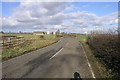


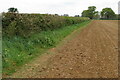
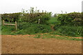
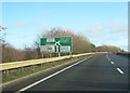

13 photos from this area
Area Information
Key information about the OX17 2AE including its size, population, and administrative classification.
- Area Type
- Postcode
- Area Size
- 8.6 hectares
- Population
- 1823
- Population Density
- 151 people/km²
House Prices in OX17 2AE
20
Properties
£699,893
Average Sold Price
£106,000
Lowest Price
£1,748,000
Highest Price
Showing 20 properties
| Address | Type | Beds | Baths | Last Sale Price | Last Sale Date | |
|---|---|---|---|---|---|---|
| The Grange, Overthorpe Road, Overthorpe, OX17 2AE | Detached | 7 | 3 | £1,460,000 | Jun 2022 | |
| Shillington, Overthorpe Road, Overthorpe, OX17 2AE | Detached | 7 | 1 | £700,000 | May 2022 | |
| Church Cottage, Overthorpe Road, Overthorpe, OX17 2AE | Terraced | 3 | 3 | £347,500 | Jun 2021 | |
| The Covert, Overthorpe Road, Overthorpe, OX17 2AE | Detached | 5 | 4 | £785,000 | Sep 2020 | |
| Sycamores, Overthorpe Road, Overthorpe, OX17 2AE | Detached | - | - | £809,000 | Jan 2020 | |
| Beech House, Overthorpe Road, Overthorpe, OX17 2AE | Bungalow | - | - | £1,005,000 | Apr 2016 | |
| The Firs, Overthorpe Road, Overthorpe, OX17 2AE | Cottage | 3 | - | £400,000 | Oct 2015 | |
| Manor Cottage, Overthorpe Road, Overthorpe, OX17 2AE | Detached | 4 | - | £670,000 | Aug 2014 | |
| Chapel House, Overthorpe Road, Overthorpe, OX17 2AE | house | - | - | £730,000 | Aug 2011 | |
| Manor House, Overthorpe Road, Overthorpe, OX17 2AE | Detached | - | - | £1,748,000 | Nov 2008 |
Page 1 of 2
Energy Efficiency in OX17 2AE
Amenities
Schools
| Rank | School | Type | Entry gender | Ages |
|---|
Explore more schools in this area
Go to Schools tabDemographics
Household Size
Two person
most common
Accommodation Type
Houses
most common
Tenure
86
majority
Ethnic Group
White
most common
Religion
N/A
most common
Household Composition
N/A
most common
Age
47
median
Adults (30-64 years)
most common
Household Deprivation
N/A
with no deprivation
NS-SEC
41
in Lower managerial occupations
Explore more demographic insights in this area
Go to Demographics tabPlanning
Planning Constraints
- Flood RiskPremium
- Ramsar Wetland SitesPremium
- Area of Outstanding Natural BeautyPremium
- Protected Nature ReservePremium
- Protected WoodlandPremium