Area Overview for OX17 1LD
Photos of OX17 1LD

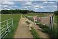
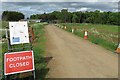
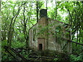

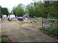
13 photos from this area
Area Information
Key information about the OX17 1LD including its size, population, and administrative classification.
- Area Type
- Postcode
- Area Size
- 40.3 hectares
- Population
- 1724
- Population Density
- 49 people/km²
House Prices in OX17 1LD
19
Properties
£385,964
Average Sold Price
£182,000
Lowest Price
£670,005
Highest Price
Showing 19 properties
| Address | Type | Beds | Baths | Last Sale Price | Last Sale Date | |
|---|---|---|---|---|---|---|
| Bellmore House, 26 Byfield Road, Chipping Warden, OX17 1LD | Semi-detached | 3 | 1 | £345,000 | Jul 2023 | |
| 28 Byfield Road, Chipping Warden, OX17 1LD | Detached | 4 | 1 | £465,000 | Mar 2023 | |
| Well Cottage, 2 Byfield Road, Chipping Warden, OX17 1LD | house | 3 | - | £380,000 | Sep 2021 | |
| 30 Byfield Road, Chipping Warden, OX17 1LD | Detached | 4 | 2 | £385,000 | Apr 2021 | |
| Amber End, 32 Byfield Road, Chipping Warden, OX17 1LD | Detached | 5 | 4 | £542,500 | Dec 2017 | |
| Fowlers Orchard, 12 Byfield Road, Chipping Warden, OX17 1LD | Detached | 4 | 2 | £480,000 | Nov 2016 | |
| Sundown Cottage, 8 Byfield Road, Chipping Warden, OX17 1LD | Cottage | 2 | 1 | £240,000 | Oct 2016 | |
| The Chapel, 10 Byfield Road, Chipping Warden, OX17 1LD | house | 5 | - | £670,005 | May 2016 | |
| Old Coach House, Byfield Road, Chipping Warden, OX17 1LD | Detached | 5 | 3 | £665,000 | Jan 2014 | |
| Beechcroft, 24 Byfield Road, Chipping Warden, OX17 1LD | Semi-detached | 4 | - | £249,950 | May 2012 |
Page 1 of 2
Energy Efficiency in OX17 1LD
Amenities
Schools
| Rank | School | Type | Entry gender | Ages |
|---|
Explore more schools in this area
Go to Schools tabDemographics
Household Size
Two person
most common
Accommodation Type
Houses
most common
Tenure
80
majority
Ethnic Group
White
most common
Religion
N/A
most common
Household Composition
N/A
most common
Age
47
median
Adults (30-64 years)
most common
Household Deprivation
N/A
with no deprivation
NS-SEC
45
in Lower managerial occupations
Explore more demographic insights in this area
Go to Demographics tabPlanning
Planning Constraints
- Flood RiskPremium
- Ramsar Wetland SitesPremium
- Area of Outstanding Natural BeautyPremium
- Protected Nature ReservePremium
- Protected WoodlandPremium