Area Overview for Overthorpe
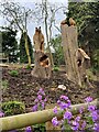
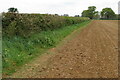
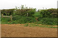
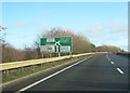
Photos of Overthorpe

Area Information
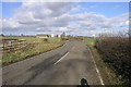
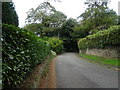
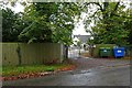
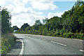
Overthorpe is a compact civil parish covering just 1.4 square kilometres. You will find a tight-knit community defined by its small size and established character. Living in Overthorpe means prioritising proximity over sprawl, as the entire area stretches less than two miles across. The village centre serves as the focal point for daily needs, with residents able to walk to local amenities without needing a vehicle for short trips. This limited footprint creates a quiet atmosphere where neighbours know each other well. The area lacks the sprawling infrastructure of larger towns, offering a sense of simplicity that appeals to those seeking a slower pace of life. Your evenings likely involve local pubs or quiet streets rather than busy commercial districts. The physical scale of Overthorpe ensures that distances are always manageable. You will appreciate how quickly you can traverse the neighbourhood on foot. The parish boundaries clearly define the limits of your everyday world.
- Area Type
- Parish
- Area Size
- 1.4 km²
- Population
- Not available
- Population Density
- Not available
Demographics
The community in Overthorpe reflects a significant shift towards retirement living. You will encounter a median age of 70 years, which places the area firmly in the retirement category for most homebuyers. Age groups skew heavily towards the older demographic, confirming Overthorpe as a destination for those leaving their working lives behind. Eighty-six per cent of households own their homes, creating a population deeply invested in their local environment. This high ownership rate suggests stability, as few families move frequently within this small parish. While specific details on household composition remain general in public records, the overall picture points to a settled crowd. Accommodation types and ethnic diversity data are not explicitly broken out in current summaries, but owner-occupied stock typically indicates long-term residents. You should expect a neighbourhood where years of residency outweigh transient populations. The absence of young families or students is evident in the age profile alone. When you think about living in Overthorpe, you are looking at a demographic built for leisure and retirement rather than career building or raising children.
Household Size
Accommodation Type
Tenure
Ethnic Group
Religion
Household Composition
Age
Household Deprivation
NS-SEC
Explore more demographic insights in this area
Go to Demographics tabPlanning
Planning Constraints
- Flood RiskPremium
- Ramsar Wetland SitesPremium
- Area of Outstanding Natural BeautyPremium
- Protected Nature ReservePremium
- Protected WoodlandPremium
- Crime RiskPremium