Area Overview for Osleston and Thurvaston
Photos of Osleston and Thurvaston

Area Information
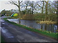
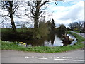
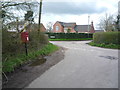
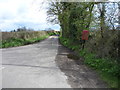
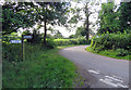
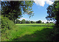
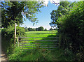
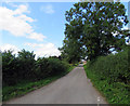
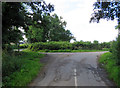
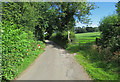
Osleston and Thurvaston is a small civil parish covering an area of 7.1 km² in England. Living in this location offers a close-knit environment defined by its manageable scale and established character. The community feels rooted, with a distinct history reflected in the local landscape. You will find yourself in a setting where daily life revolves around local amenities and a slower pace compared to major urban centres. The parish structure indicates a level of local governance designed to support residents within these specific boundaries. Daily life here is coloured by the practicalities of village living. Proximity to neighbours can be a significant benefit for those who prefer a familiar neighbourhood. However, the small size of the parish means services are often located in specific villages within the wider area. You should consider how this compact geography fits your routine. The area maintains a traditional identity, avoiding the rapid changes seen in larger developing towns. For you, living in Osleston and Thurvaston means embracing a lifestyle where the community extends close to your doorstep. It is a place where the past and present coexist without the noise of major infrastructure projects disrupting the peace.
- Area Type
- Parish
- Area Size
- 7.1 km²
- Population
- Not available
- Population Density
- Not available
Demographics
The community in Osleston and Thurvaston displays a clear demographic profile characterised by an older population. The median age here is 70, indicating that the area is dominated by seniors and long-term residents. This age distribution shapes the social fabric and the types of community activities that take place throughout the parish. With mostCommonAgeRange data pointing to this older cohort, you can expect a neighbourhood where experience and stability are the norm. Home ownership stands at an impressive 86%, meaning the vast majority of people in this parish own their homes outright or with a mortgage. This high level of ownership suggests a stable community where people are often invested in their local surroundings for the long term. Household composition and accommodation types reflect this settled nature, with families and individuals largely prioritising permanence over renting. While specific data on ethnicity and religion is not explicitly detailed in the current figures, the overwhelming prevalence of home ownership creates a distinct sense of tenure. For you, living in Osleston and Thurvaston means entering a community where the population is older and property is rarely on the rental market. The environment is tailored to the needs of an aging population rather than transient workers or young renters. You will find a consistent building style and demographic group that has lived in these homes for generations. This stability provides a predictable environment for those seeking a quiet, established place to live.
Household Size
Accommodation Type
Tenure
Ethnic Group
Religion
Household Composition
Age
Household Deprivation
NS-SEC
Explore more demographic insights in this area
Go to Demographics tabPlanning
Planning Constraints
- Flood RiskLocked
- Ramsar Wetland SitesLocked
- Area of Outstanding Natural BeautyLocked
- Protected Nature ReserveLocked
- Protected WoodlandLocked
- Crime RiskLocked