Area Overview for Offcote and Underwood
Photos of Offcote and Underwood
Area Information
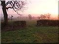
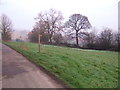
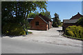
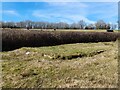
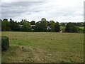
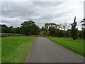
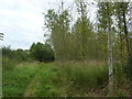
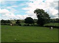
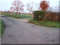
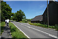
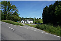
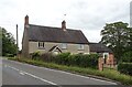
Living in Offcote and Underwood involves embracing a small, self-contained civil parish with a distinctly rural character. The area covers just 7.9 square kilometres, creating a tight-knit community where daily life incorporates extensive walking and local activities rather than heavy reliance on urban centres. This limited footprint defines the neighbourhood, offering a quiet environment for residents seeking an escape from city noise while remaining in England. The community functions as a standalone entity, relying on its proximity to broader towns for larger amenities instead of incorporating expansive commercial zones within its own borders. You can expect a slow pace where the land is open and the atmosphere is calm. The consensus suggests that the fastest way to understand the area is to drive or walk its small perimeter, revealing its true nature. People choose this spot for the sense of space and the ability to maintain a straightforward lifestyle without the congestion of larger settlements. The local environment provides a backdrop for a life focused on nature and simplicity. Candidates considering homes in Offcote and Underwood should prioritise a quiet lifestyle over immediate access to high-revenue commercial districts. The area stands as a practical choice for those who value familiarity and spatial clarity over urban convenience.
- Area Type
- Parish
- Area Size
- 7.9 km²
- Population
- Not available
- Population Density
- Not available
Demographics
The community profile in Offcote and Underwood reveals a very distinct age segment compared to the national average. The median age for residents is 70 years, indicating a population dominated by older adults and likely retirees. This demographic concentration suggests the area serves as a retirement destination or a settlement for families with children who have moved on to empty nest life. You will find that Age: Total is the primary category for the census data available, confirming the breadth of the older demographic presence across the parish. Home ownership stands at a high level of 70% within Offcote and Underwood. This figure implies that residents have significant financial stability and a long-term stake in the local housing stock. The high ownership rate reduces the volume of rental listings and creates a stable neighbourhood where people are expected to remain for many years. Household composition and accommodation type data confirms the predominance of owner-occupier households rather than private renters or shared living arrangements. The ethnic diversity and religious makeup are recorded as total figures, reflecting the standard demography of a settled UK parish without major recent migration shifts. This stability contrasts with fast-growing urban areas where turnover is high. You can expect a quiet society where neighbours know one another and community bonds reflect years of shared residency.
Household Size
Accommodation Type
Tenure
Ethnic Group
Religion
Household Composition
Age
Household Deprivation
NS-SEC
Explore more demographic insights in this area
Go to Demographics tabPlanning
Planning Constraints
- Flood RiskLocked
- Ramsar Wetland SitesLocked
- Area of Outstanding Natural BeautyLocked
- Protected Nature ReserveLocked
- Protected WoodlandLocked
- Crime RiskLocked