Area Overview for Oakthorpe and Donisthorpe
Photos of Oakthorpe and Donisthorpe
Area Information
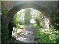
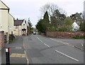
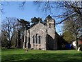
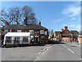
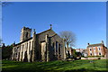
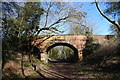
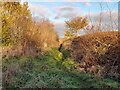
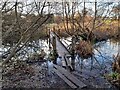
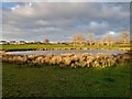
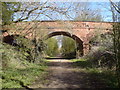
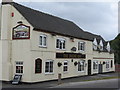
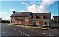
This civil parish lies within the North West Leicestershire district of Leicestershire, situated approximately three miles southwest of Ashby-de-la-Zouch. You will find yourself near the border with South Derbyshire, occupying a total area of 7.4 square kilometres. Oakthorpe and Donisthorpe were first mentioned in 1086, yet their administrative history is complex; much of this land remained a Derbyshire exclave until the boundary transfer to Leicestershire in 1897. Originally a mining hub with coal extraction active since 1412, the area seen today reflects the completion of colliery closures in the 1990s. This transition has shaped a quieter, predominantly rural residential landscape characterised by villages and hamlets including the settlement of Acresford. Daily life here differs significantly from a bustling town centre. The community formerly supported shops and pubs linked to the local industry, but these have largely vanished. You may only find one active pub serving the area in Donisthorpe. Most households reside in properties converted from former industrial zones or built for post-mining residents. You will find the decoration of St John the Evangelist Church from 1838 standing in Donisthorpe as a historic landmark. Recent planning efforts have repurposed former colliery sites into Donisthorpe Woodland Park, providing ecological and recreational space for current residents. This parish offers a grounded, low-rise living environment where the rhythm of life has slowed considerably since the industrial era.
- Area Type
- District Borough Unitary Ward
- Area Size
- 7.4 km²
- Population
- Not available
- Population Density
- Not available
Demographics
The demographic profile of Oakthorpe and Donisthorpe reveals a community settled by older generations. The median age stands at 70 years, making this one of the oldest active civil parishes in England. This high average age reflects the dominance of the Age group as the most common age range among residents. A significant 77 per cent of all households own their homes outright or with a mortgage, indicating a community of settled residents rather than transient tenants. The remaining 23 per cent live in rented accommodation, though specific breakdowns of private versus social renting are not detailed in available records. The area functions as a static population hub where residents have likely lived for decades. This high stability correlates with the limited local employment shifts after the 1990s mine closures. You will find that household compositions generally suit retired couples or extended families living in the converted miners' welfare buildings and traditional cottages. The population density matches the small land area of 7.4 square kilometres, creating a sparse rural feel rather than a multi-generational family mix. Specific figures on ethnic diversity or religious affiliation are not provided for this jurisdiction, meaning you rely on the broader homogeneous trends typical of deep-rural districts. The 77 per cent home ownership rate means community decisions often favour long-term stability over rapid turnover.
Household Size
Accommodation Type
Tenure
Ethnic Group
Religion
Household Composition
Age
Household Deprivation
NS-SEC
Explore more demographic insights in this area
Go to Demographics tabPlanning
Planning Constraints
- Flood RiskPremium
- Ramsar Wetland SitesPremium
- Area of Outstanding Natural BeautyPremium
- Protected Nature ReservePremium
- Protected WoodlandPremium
- Crime RiskPremium