Area Overview for Oakham North West Ward
Photos of Oakham North West Ward
Area Information
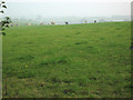
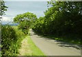
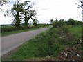
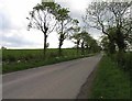
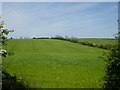
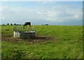
Oakham North West Ward defines itself through stability and quiet convenience, covering a total area of 3.7 square kilometres within the district. This compact footprint creates a distinctly residential environment where daily life revolves on local community interactions rather than urban chaos. The ward sits within the broader context of a historic market town, yet it maintains a separate identity characterised by lower density and older housing stock. You will find that this area is not a sprawling suburb but a focused pocket of Brampton or similar municipal planning where the pace of life remains steady. The small size means that distances are short, and the local high street or village centre is always within walking distance for most residents. Living in Oakham North West Ward suits those who prefer a settled rhythm over rapid growth. The area does not boast massive commercial zones or heavy industrial parks, which keeps noise levels lower and air quality relatively stable. Instead, the ward offers a mix of council housing and private mansions that have defined the local character for generations. You can expect a neighbourhood where boundaries are clear and the sense of place is strong. The physical layout supports a lifestyle centred around footpaths, local parks, and community gatherings rather than congested roads. This is an established part of Oakham where the grid of streets follows historic patterns, offering a unique charm that modern new-build estates cannot replicate.
- Area Type
- District Borough Unitary Ward
- Area Size
- 3.7 km²
- Population
- Not available
- Population Density
- Not available
Demographics
The community within Oakham North West Ward reflects a generation settling down and staying put. With a median age of 70, the population is heavily weighted towards older adults, creating a demographic profile that is distinct from commercial hubs or student towns. Most residents fall into age groups typical of the baby boomer generation and those who have retired to the area. You are likely to encounter neighbours who have called Oakham home for decades, building long-standing social networks that define the local culture. This age distribution suggests an environment where community interests centre around health, leisure, and local events rather than career networking or nightlife. Home ownership stands at a remarkable 80% across the ward, indicating that the vast majority of households own their properties outright or have substantial equity. This high percentage of owner-occupiers contrasts sharply with areas dominated by social housing or private rentals, reinforcing the stability of the community. The households here are predominantly composed of single people or couples living in their own homes, rather than families with young children moving frequently. You will find a consistent population base where residents are invested in the long-term improvement of their local streets and amenities. This demographic reality means that council tax payers are usually permanent residents, fostering a neighbourhood where local services are supported by a steady, engaged voting bloc.
Household Size
Accommodation Type
Tenure
Ethnic Group
Religion
Household Composition
Age
Household Deprivation
NS-SEC
Explore more demographic insights in this area
Go to Demographics tabPlanning
Planning Constraints
- Flood RiskPremium
- Ramsar Wetland SitesPremium
- Area of Outstanding Natural BeautyPremium
- Protected Nature ReservePremium
- Crime RiskPremium