Area Overview for Oadby and Wigston District (B)
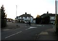
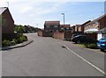
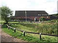
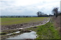
Photos of Oadby and Wigston District (B)


Area Information
Oadby and Wigston District (B) covers 23.5 km² of territory within England. This compact district offers a distinct residential environment for those seeking a specific type of living in Oadby and Wigston District (B). The area functions as a cohesive community with a clear demographic identity rather than a sprawling conurbation. Residents navigate a landscape where local services are concentrated within a relatively small geographic footprint. Daily life here revolves around a population with a defined social structure, as evidenced by the age distribution across the borough. Prospective buyers considering homes in Oadby and Wigston District (B) find a setting that prioritises established neighbourhoods over rapid development. The district's scale means that facilities are situated close to where people live. You will encounter an environment where the rhythm of life is dictated by local rather than regional factors. This setting appeals to individuals who value a contained community over the anonymity of larger cities. The physical size of the area contributes to a sense of place that is distinct from surrounding rural or urban zones. Living in Oadby and Wigston District (B) means participating in a demographic profile that skews towards older age groups. Your daily commute and local interactions will reflect this specific community makeup.
- Area Type
- District/Borough
- Area Size
- 23.5 km²
- Population
- Not available
- Population Density
- Not available
Demographics
The community character of Oadby and Wigston District (B) is defined by a significant age skew towards residents over seventy years old. Your nearest neighbours in Oadby and Wigston District (B) are likely to be from the older generation, creating a demographic landscape different from typical metropolitan centres. The median age of the population reaches seventy years, indicating a substantial presence of retirees or established older adults. Home ownership stands at 76% within this district, suggesting a stable resident base that has settled into the area. This high rate of ownership implies that many households in Oadby and Wigston District (B) possess long-term roots in the community. The household composition data reflects a total population structure where families may be fewer compared to areas with younger demographics. You can expect a neighbourhood where single occupancy or adult couples dominate the housing stock. Ethical and religious diversity metrics indicate a total population figure without a specific predominant group highlighted in the current breakdown. Safety assessments confirm a crime risk level that passes with a score of 70 out of 100. This low crime risk score places Oadby and Wigston District (B) below average for crime rates. Your quality of life benefits from these security conditions while you navigate the daily routines of a quieter, older demographic.
Household Size
Accommodation Type
Tenure
Ethnic Group
Religion
Household Composition
Age
Household Deprivation
NS-SEC
Explore more demographic insights in this area
Go to Demographics tabPlanning
Planning Constraints
- Flood RiskPremium
- Ramsar Wetland SitesPremium
- Area of Outstanding Natural BeautyPremium
- Protected Nature ReservePremium
- Protected WoodlandPremium
- Crime RiskPremium