Area Overview for Nuthall East & Strelley Ward
Photos of Nuthall East & Strelley Ward
Area Information
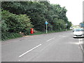
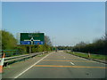
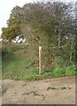
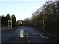
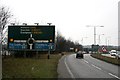
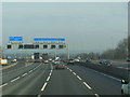
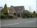
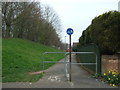
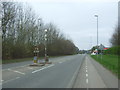
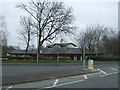
Nuthall East & Strelley Ward occupies a distinct northwest corner of Broxtowe Borough, covering an area of 6.8 square kilometres. You are looking at a location approximately 4.5 miles from Nottingham city centre, situated at coordinates near 52.98623351500853, -1.2355234091583516. This ward blends the character of a traditional village with the reality of suburban expansion split by major infrastructure. The history of the area is deeply rooted, with Nuthall first appearing in the Domesday Book of 1086. St Patrick's Church stands as the historic anchor, built around 1390 under Sir Robert Cokefield. You will find that the landscape includes remnants of the past, such as Nuthall Temple, which was demolished in 1928 for the M1 motorway and now lies beneath the road. Daily life here involves navigating the boundary between the quiet village core of Strelley and the developed sections of Nuthall. The ward was once entirely rural, comprising 1,644 acres in 1870 before evolving into a patchwork of East and West Nuthall. Post-war growth saw the construction of the Mornington Crescent Estate in the 1980s and 1990s, adding density to the environment. You live in an area where the M1 motorway acts as a physical divider, creating unique neighbourhood dynamics on each side. The ward benefits from Broxtowe Country Park, which borders New Nuthall and offers green space adjacent to built-up areas.
- Area Type
- District Borough Unitary Ward
- Area Size
- 6.8 km²
- Population
- Not available
- Population Density
- Not available
Demographics
The community within Nuthall East & Strelley Ward skews significantly older than the national average, with a median age of 70. This demographic profile suggests a settlement that attracts retirees or long-term residents who have stayed as they aged. You are entering an environment where the average person is likely to be much older than the typical UK household member. The data indicates a strong preference for home ownership, with 85% of residents being owner-occupiers. This high level of ownership implies a stable community where people have invested in their local surroundings and are likely to have lived there for many years. Household composition within the ward reflects this mature population, though specific breakdowns for couples without children or single-person households are not detailed in the available records. Religion, predominant ethnic groups, and specific religious affiliations are recorded in the local census but are not broken down by specific denomination or nationality in the current dataset. Consequently, you cannot derive precise statistics on diversity without further specific data points. The absence of mixed-age housing clusters points away from a family-centric market. Instead, homes in Nuthall East & Strelley Ward cater to those seeking quiet, established neighbourhoods rather than dynamic, youthful districts. This demographic reality shapes the local amenities and services, favouring cafes and quieter parks over busy youth venues or comprehensive schools nearby.
Household Size
Accommodation Type
Tenure
Ethnic Group
Religion
Household Composition
Age
Household Deprivation
NS-SEC
Explore more demographic insights in this area
Go to Demographics tabPlanning
Planning Constraints
- Flood RiskPremium
- Ramsar Wetland SitesPremium
- Area of Outstanding Natural BeautyPremium
- Protected Nature ReservePremium
- Protected WoodlandPremium
- Crime RiskPremium