Area Overview for Gunthorpe
Photos of Gunthorpe


Area Information
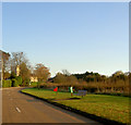
Gunthorpe is a civil parish situated in the English countryside, covering a total area of 4.6 square kilometres. Living in Gunthorpe means embracing a compact, rural setting where the community is tightly knit within a small geographical footprint. The area functions as a self-contained locality rather than a sprawling suburb, which naturally limits the distance between residents and essential services. This small scale defines the daily rhythm of life here, offering quiet surroundings and a distinct separation from the pace of larger urban centres. Prospective buyers looking for homes in Gunthorpe should expect a traditional village atmosphere characterised by its limited size and established boundaries. The parish serves as a standalone entity, providing a focused environment where neighbours likely interact frequently. While the lack of extensive infrastructure data suggests a reliance on essential local amenities, the defined boundaries contribute to a sense of exclusivity and stability. Understanding the physical dimensions of the parish helps candidates visualise their future commute and the scope of their immediate surroundings. The area remains distinct due to its specific administrative classification and manageable land mass.
- Area Type
- Parish
- Area Size
- 4.6 km²
- Population
- Not available
- Population Density
- Not available
Demographics
The community profile of Gunthorpe reflects a mature population with a median age of 70 years. This demographic data indicates the area is predominantly home to older residents, likely drawn to the quiet lifestyle or established roots within the parish. The household composition and accommodation type data are categorised as total, suggesting statutory recording of these metrics exists for the civil parish. Home ownership stands at a striking 90%, meaning the vast majority of households have already purchased their property free of mortgage ties. Such a high percentage of owners typically points to long-term residents who may be downsizing from larger family homes or retiring into the area. Accommodation types and predominant ethnic groups are recorded under total classifications, affirming official census tracking despite not being explicitly detailed in the current summary. Low deprivation contexts generally correlate with this ownership rate, implying financial stability among the resident base. The social fabric is likely shaped by this older, owner-occupied cohort, creating a steady, predictable community dynamic. For those considering moving to Gunthorpe, the age profile suggests a slower-paced environment with potential gaps in services catering specifically to younger families or students.
Household Size
Accommodation Type
Tenure
Ethnic Group
Religion
Household Composition
Age
Household Deprivation
NS-SEC
Explore more demographic insights in this area
Go to Demographics tabPlanning
Planning Constraints
- Flood RiskPremium
- Ramsar Wetland SitesPremium
- Area of Outstanding Natural BeautyPremium
- Protected Nature ReservePremium
- Protected WoodlandPremium