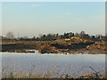
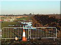
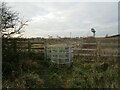
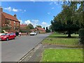
Area Overview for Farndon
Photos of Farndon


Area Information
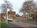
Living in Farndon offers a distinct experience within the civil parish of the same name in Cheshire, England. The area encompassed is small but defined, covering an total of 7.1 km². This compact footprint creates a close-knit environment where daily life moves at a particular pace. You will find a locality characterised by established residential patterns rather than rapid urban expansion. The setting provides a clear sense of place for those seeking a specific type of neighbourhood. Daily routines here often involve local access to amenities within the parish boundaries. The size of Farndon dictates a manageable community where services are likely concentrated. Buyers considering this location must weigh the limited land area against the established character. It is a place where the built environment reflects a long-standing history rather than modern sprawl. The geography supports a contained lifestyle for families and individuals alike. Farndon remains a distinct entity on the map, separate yet connected to its surrounding districts. You navigate a landscape defined by its specific dimensions and historical development. The area presents itself as a defined residential zone with clear boundaries. This专心 focus on a single parish creates a homogenous living experience for all residents.
- Area Type
- Parish
- Area Size
- 7.1 km²
- Population
- Not available
- Population Density
- Not available
Demographics
The community in Farndon reflects an exceptionally mature demographic profile. You will find that the median age across the parish is 70 years old. This figure indicates a population heavily weighted towards older residents and retired individuals. The most common age range spans the total population, suggesting a low density of young families or young professionals. For context, this age distribution stands in contrast to typical growth areas where under-thirties dominate the census data. Home ownership rates stand at a staggering 79%, which signals a community built by those who have settled permanently rather than short-term tenants. This high rate of ownership typically correlates with long-term stability within the streets. The accommodation types and household composition data confirm a standard residential pattern without unusual deviations. You can expect a neighbourhood where the majority of households continue to live in properties they purchased decades ago. This demographic reality shapes local services, from school availability to leisure facilities. The lack of a younger demographic means town centres may function differently than in mixed-age villages. Living in Farndon means engaging with a community defined by experience and longevity rather than transience.
Household Size
Accommodation Type
Tenure
Ethnic Group
Religion
Household Composition
Age
Household Deprivation
NS-SEC
Explore more demographic insights in this area
Go to Demographics tabPlanning
Planning Constraints
- Flood RiskPremium
- Ramsar Wetland SitesPremium
- Area of Outstanding Natural BeautyPremium
- Protected Nature ReservePremium
- Protected WoodlandPremium