Area Overview for Greasley
Photos of Greasley

Area Information
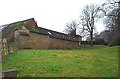
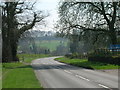
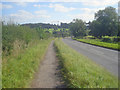
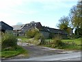
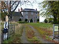
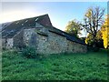
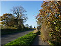
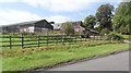
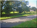
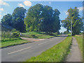
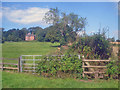
Greasley is a civil parish located in the Broxtowe district of Nottinghamshire, sitting northwest of Nottingham. This area spans 19.8 km² and is home to 1,576 residents. The parish encompasses several built-up areas, including Beauvale, Giltbrook, Moorgreen, Newthorpe, and Watnall, alongside parts of Eastwood, Kimberley and Nuthall. Historically, Greasley began as a large rural parish of up to 5,363 acres. Records from 1870-72 described the hamlet of Moor Green as being 2.5 miles east of Langley Mill railway station and 7 miles northwest of Nottingham. The community includes specific landmarks such as St Mary's Church, a Grade II listed building dating to the mid-15th century, and the ruins of Greasley Castle. Living in Greasley often means having access to rural roots combined with proximity to larger towns. The population density stands at 80 people per km², reflecting a settlement that balances open space with residential development. The area carries a distinct historical legacy, from the Domesday Book records of 1086 to the establishment of Beauvale Priory in 1343. Today, the village serves residents and commuters who work in Nottingham and Derby. Understanding the geography of Greasley involves recognising how these separate hamlets function as a single administrative unit under the Broxtowe district. This layout offers a specific type of settlement experience distinct from a dense urban core.
- Area Type
- Parish
- Area Size
- 19.8 km²
- Population
- 1576
- Population Density
- 80 people/km²
Demographics
The community in Greasley is defined by a mature population profile. The current median age for residents is 70 years old. This figure indicates a demographic where many households are likely comprised of older adults or families with grown children who live nearby. The most common age range is recorded as the total age range, which is not a specific segment but reflects the aggregate data available for this parish. With a median age of 70, the neighbourhood presents a quiet environment where daily life moves at a slower pace compared to younger-only districts. Home ownership is extremely high within Greasley. The data shows that 86% of residents own their homes outright or have a mortgage. This high rate suggests that the local housing market is dominated by long-term owners rather than private landlords or short-term lettings. Such a statistic usually correlates with high job turnover for families or a strong link to retirement, which may influence local demand for rental properties. The household composition and accommodation type data are recorded under the general category of total, meaning detailed breakdowns of specific family units are not provided in the current dataset. However, the high ownership percentage of 86% provides a clear indication of the area's character. Ethnicity and religious diversity data are currently classified under total categories without specific breakdowns provided for this parish. While exact percentages for different ethnic groups or religious affiliations are not listed, the community structure leans heavily towards home ownership. This economic profile often supports stable neighbourhoods with established local businesses. The lack of specific diversity metrics means the demographic picture relies heavily on age and ownership figures. You should expect a community where stability and established residency play a major role in social interactions and local governance.
Household Size
Accommodation Type
Tenure
Ethnic Group
Religion
Household Composition
Age
Household Deprivation
NS-SEC
Explore more demographic insights in this area
Go to Demographics tabPlanning
Planning Constraints
- Flood RiskPremium
- Ramsar Wetland SitesPremium
- Area of Outstanding Natural BeautyPremium
- Protected Nature ReservePremium
- Protected WoodlandPremium