Area Overview for Brinsley
Photos of Brinsley
Area Information
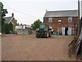
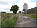
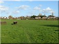
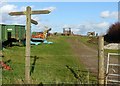
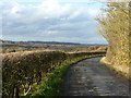
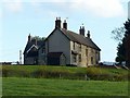
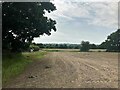
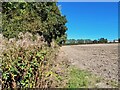
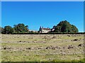
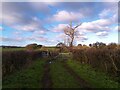
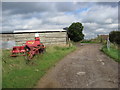
Brinsley is a civil parish in Nottinghamshire, situated in the East Midlands at the approximate boundary of Derbyshire. The area spans 3.9 km² and holds a population of around 2,284 residents, a figure that fell from 2,327 in 2011 to its current level by 2021. You are looking at a location that has transitioned from a former coal-mining village into a setting defined by rural countryside and organic farms. Local planning and heritage groups, such as the D.H. Lawrence Heritage organisation, manage leisure walking paths that thread through the landscape. Daily life here centres on strong community atmosphere, visible through volunteer-led events like the annual Brinsley Carnival. This festival began as a hospital parade in the early 1900s and restarted in 1960 by postmaster George Mills. The village is split into Old Brinsley, within the Broxtowe district, and New Brinsley, located in the Ashfield district. You will find key landmarks such as the restored Brinsley Headstocks, which are the only surviving tandem timber examples from the former colliery, now managed by the Friends of Brinsley Headstocks. Living in Brinsley means enjoying a distinct mix of historical industry, conservation efforts, and quiet village life near Sherwood Forest.
- Area Type
- Parish
- Area Size
- 3.9 km²
- Population
- Not available
- Population Density
- Not available
Demographics
The community in Brinsley has a defined character, with a median age of 70 years old. This age profile indicates that the area is predominantly occupied by older residents. Household composition data reflects this trend, showing a population structure typical of a retirement or semi-retirement location. Despite the age skew, 83% of residents own their homes outright. This high level of home ownership suggests a stable, settled community where most people have a significant long-term commitment to the area. There are no specific statistics provided regarding ethnic diversity or religious affiliation in the available data, so you cannot make claims in those areas. The most common age range is listed simply as 'Age: Total', confirming that age is the primary demographic marker. For homebuyers, this environment offers peace and quiet rather than the bustle of a young family hub. You are not entering a market characterised by transient turnover but rather a place where existing owners have taken root. The low proportion of younger households combined with high ownership rates creates a specific type of neighbourly dynamic where privacy is valued and community events like the carnival rely heavily on long-standing local volunteers.
Household Size
Accommodation Type
Tenure
Ethnic Group
Religion
Household Composition
Age
Household Deprivation
NS-SEC
Explore more demographic insights in this area
Go to Demographics tabPlanning
Planning Constraints
- Flood RiskPremium
- Ramsar Wetland SitesPremium
- Area of Outstanding Natural BeautyPremium
- Protected Nature ReservePremium
- Protected WoodlandPremium