Area Overview for Beckingham
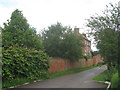
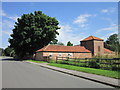
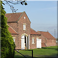
Photos of Beckingham


Area Information
Beckingham is a built-up area in England covering 68.7 hectares, with a population skewed toward older residents, as the median age is 70. This suggests a community rooted in stability, where many residents have lived for decades. The area’s compact size means amenities and services are within practical reach, fostering a sense of local cohesion. Beckingham is not a sprawling suburb but a focused settlement, with a mix of housing types that cater to its demographic profile. While it lacks the density of larger cities, its proximity to nearby towns like Gainsborough offers access to broader opportunities. Daily life here is likely characterised by routine, with residents prioritising comfort and familiarity. The area’s low crime risk and established infrastructure make it appealing for those seeking a quiet, secure place to live. For homebuyers, Beckingham represents a blend of practicality and tranquility, though its appeal may be limited to those who value a slower pace of life over urban vibrancy.
- Area Type
- Built Up Area 250
- Area Size
- 68.7 hectares
- Population
- Not available
- Population Density
- Not available
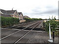
Beckingham’s lifestyle is shaped by its proximity to retail and rail services. Within reach are five retail outlets, including Lincolnshire Co-operative Co, Heron Gainsborough, and Lidl Beaumont, offering everyday shopping needs. The two railway stations provide access to broader networks, enabling travel to Gainsborough and beyond. While the data does not mention parks or leisure facilities, the presence of retail and transport options suggests a functional daily life. The area’s compact size means amenities are walkable, though the lack of detailed information on parks or recreational spaces leaves gaps in understanding leisure opportunities. For residents, the balance of retail and transport infrastructure supports a practical, low-maintenance lifestyle, though it may lack the cultural or green spaces found in larger towns.
Amenities
Schools
Beckingham Primary School is the only school explicitly listed in the data, serving the area’s younger residents. It is a primary school with an Ofsted rating of “good,” indicating a satisfactory standard of education. The absence of secondary schools or additional educational institutions suggests that families may need to travel to nearby towns for secondary education. This could be a consideration for parents prioritising a full range of schooling options. The single school listed reflects the area’s smaller scale, but the “good” rating provides reassurance about the quality of primary education available. For those valuing proximity to schools, Beckingham’s primary offering is reliable, though secondary education may require commuting.
| Rank | School | Type | Entry gender | Ages |
|---|
Explore more schools in this area
Go to Schools tabDemographics
The population of Beckingham is predominantly older, with a median age of 70, indicating a community where retirees and long-term residents form the majority. Home ownership is high at 78%, suggesting a stable housing market with few rental properties. This reflects a demographic that values long-term investment in property. The data does not specify household composition or accommodation types, but the high ownership rate implies a mix of family homes and single-occupancy residences. The area’s age profile may influence local services, with healthcare and leisure facilities tailored to older adults. While the data does not quantify diversity or deprivation, the absence of specific figures suggests a homogeneous community with limited socioeconomic variation. For buyers, this means a predictable market but potentially fewer options for younger families or renters.