Area Overview for Rushden
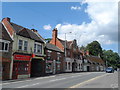
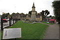
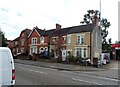
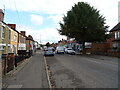
Photos of Rushden


Area Information
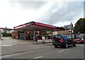
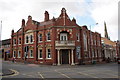
Rushden is a built-up area in England covering 8.0 km², home to 9,626 residents. With a population density of 1,197 people per square kilometre, it is a compact community where daily life unfolds in a mix of residential and local amenities. The area’s character is shaped by its older demographic profile, with a median age of 70, suggesting a community that may be more established and less transient. Rushden is not a sprawling suburb but a focused town where proximity to essential services and transport links plays a key role in daily routines. Residents benefit from nearby retail hubs, including Tesco and Lidl, and a rail connection to Wellingborough station, which provides access to broader regional networks. The area’s compact size means most amenities are within practical reach, making it suitable for those prioritising convenience over expansive space. For buyers, Rushden offers a blend of affordability and accessibility, though its older population profile may influence the types of housing available.
- Area Type
- Built Up Area 250
- Area Size
- 8.0 km²
- Population
- 9626
- Population Density
- 1197 people/km²
Rushden’s lifestyle is defined by its proximity to retail and transport hubs. The area includes notable shops such as Tesco Rushden, Iceland Rushden, and Lidl Newton, offering everyday convenience for residents. The Wellingborough Railway Station provides access to regional travel, making it easier to commute to larger cities or explore surrounding areas. While the data does not mention parks or leisure facilities, the compact nature of the area suggests that local amenities are within walking or short driving distance. The presence of multiple primary schools and retail options indicates a community focused on practicality and accessibility. For those prioritising convenience over expansive green spaces, Rushden’s amenities align with a lifestyle that values ease of access to essentials.
Amenities
Schools
Rushden is served by five primary schools, including Alfred Lord Tennyson School-2 Sites and South End Infant School, both of which hold a ‘good’ Ofsted rating. Other schools in the area include Hayway Infant and Nursery School, Newton Road Junior School, and Newton Road Infant School. The presence of multiple primary schools provides families with several options, though the data does not indicate secondary education facilities within the area. The ‘good’ ratings for two of the primary schools suggest a baseline quality of education, though parents should verify current Ofsted reports for the most up-to-date assessments. The concentration of primary schools may be particularly beneficial for families with young children, but those requiring secondary schooling may need to look beyond Rushden’s boundaries.
| Rank | School | Type | Entry gender | Ages |
|---|
Explore more schools in this area
Go to Schools tabDemographics
Rushden’s population is predominantly older, with a median age of 70, indicating a community where retirement or long-term residency is common. The home ownership rate is 68%, suggesting that most properties are owner-occupied rather than rented. This figure implies a stable housing market where long-term investment is prevalent. The data does not specify household composition or accommodation types, but the high population density of 1,197 people per km² points to a mix of smaller homes and shared living arrangements. The absence of detailed diversity metrics means the area’s cultural or ethnic composition remains unspecified, though the overall population profile suggests a community with fewer young families and more mature residents. This demographic structure may influence local services and amenities, which appear tailored to older adults rather than growing families.