Area Overview for North Wingfield Central Ward
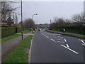
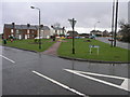
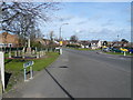
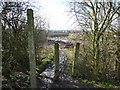
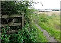
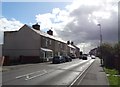
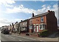
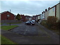
Photos of North Wingfield Central Ward
Area Information
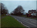
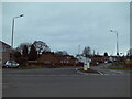
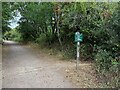
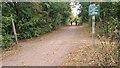
North Wingfield Central Ward sits within the county of Derbyshire in the East Midlands region of England. This district ward encompasses a total area size of 4.9 km², making it a compact locality for residents seeking a specific community footprint. The ward forms part of the North Wingfield parish and operates within the administrative structure of North East Derbyshire. It functions as one of 22 wards that comprise the North East Derbyshire County Constituency. Located at precise coordinates of 53.18410191127084, -1.3830753725216582, the location shares the S postcode area with other nearby villages. The ward appears on the Derbyshire County map and falls within the boundary of the North East Derbyshire Green Belt. This green belt is associated with the South and West Yorkshire Green Belt, a designation that links the area with larger towns such as Dronfield, Eckington, and Killamarsh. Living in North Wingfield Central Ward means residing in a defined rural or semi-rural context that is administratively tied to the broader Sheffield transport and planning zones. The area represents a distinct unit within the English local government system, balancing parish-level identity with county-wide constituency representation. Prospective buyers looking at homes in North Wingfield Central Ward are entering a space defined by these clear geographical and political boundaries rather than sprawling urban expansion.
- Area Type
- District Borough Unitary Ward
- Area Size
- 4.9 km²
- Population
- Not available
- Population Density
- Not available
Demographics
The community in North Wingfield Central Ward presents a specific demographic profile characterised by an older population. The median age for residents is 70 years old, indicating a significant elderly presence within the ward. While the data categorises the most common age range simply under the total population mark, the high median age suggests a settlement that does not attract young families in large numbers. Home ownership levels in the area stand at 62 per cent, meaning nearly two out of three households own their property outright or with a mortgage. This high ownership rate is typical of older estates where residents have built long-term ties to their local environment. Household composition and accommodation type data are recorded as totals in the available information, suggesting a homogenous mix of living arrangements rather than a diverse range of multi-generational or student housing. The predominant ethnic group, religion, and specific age breakdowns are listed as total categories without further subdivision, reflecting a lack of varied statistical reporting for this specific ward. Deprivation metrics are not explicitly detailed in the provided figures. Consequently, the community functions as a self-contained unit where the majority of inhabitants are established owners within a populated zone that skews towards senior living. Anyone considering homes in North Wingfield Central Ward should expect a neighbourhood accustomed to the needs of an older demographic.
Household Size
Accommodation Type
Tenure
Ethnic Group
Religion
Household Composition
Age
Household Deprivation
NS-SEC
Explore more demographic insights in this area
Go to Demographics tabPlanning
Planning Constraints
- Flood RiskPremium
- Ramsar Wetland SitesPremium
- Area of Outstanding Natural BeautyPremium
- Protected Nature ReservePremium
- Protected WoodlandPremium
- Crime RiskPremium