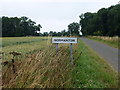
Area Overview for Normanton
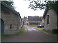
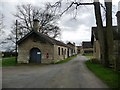
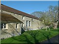
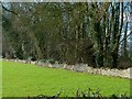
Photos of Normanton


Area Information
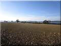
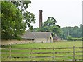
Living in Normanton offers a quiet experience within a compact district borough unitary ward covering just 2.9 square kilometres. The area presents a distinct character defined by its density and specific planning constraints rather than expansive suburban sprawl. Residents here navigate a setting where low flood risk provides daily reassurance, yet the presence of Ramsar wetland sites introduces specific planning considerations for any future developments. This small footprint means amenities are likely concentrated, creating a neighbourhood life where daily necessities are potentially within short walking distances. The absence of Areas of Outstanding Natural Beauty or protected woodland boundaries within the immediate coverage suggests the landscape is managed for general use rather than strict preservation. You might find that the local environment balances built infrastructure with sensitive ecological zones, demanding attention from those interested in building or extending properties. The area's small size contributes to a cohesive community feel, where the geography limits sprawl and fosters interconnectedness. Understanding these physical boundaries helps you appreciate the unique constraints and advantages of living or investing in this specific locale. The safety profile remains a strong asset, with low crime rates supporting a calm residential atmosphere.
- Area Type
- District Borough Unitary Ward
- Area Size
- 2.9 km²
- Population
- Not available
- Population Density
- Not available
Demographics
The community in Normanton reflects a settled population with a significant tilt towards older residents. The median age stands at 70 years, indicating that the area is dominated by retirees and those in later life stages. Age data reports show the total age range as the primary indicator, confirming the broad elderly demographic composition. Approximately 64% of households own their homes, painting a clear picture of a stable, owner-occupied community rather than a student or transient rental market. This high ownership rate suggests residents have established long-term ties to the locality. The data does not specify breakdowns for household composition types, predominant ethnic groups, or religious affiliations, but the overall statistics point to a mature demographic structure. Such an age profile often correlates with quieter streets and a demand for accessible housing. When considering quality of life, the high home ownership percentage implies that residents are invested in maintaining their local improvements and community standing. Planning decisions here likely reflect the needs of an older population, though the specific social dynamics vary across these age groups.
Household Size
Accommodation Type
Tenure
Ethnic Group
Religion
Household Composition
Age
Household Deprivation
NS-SEC
Explore more demographic insights in this area
Go to Demographics tabPlanning
Planning Constraints
- Flood RiskPremium
- Ramsar Wetland SitesPremium
- Area of Outstanding Natural BeautyPremium
- Protected Nature ReservePremium
- Protected WoodlandPremium
- Crime RiskPremium