Area Overview for NN9 7QW
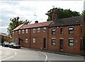
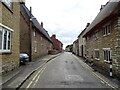
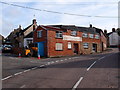
Photos of NN9 7QW

Area Information
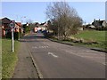
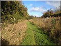
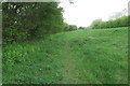
NN9 7QW represents a specific residential cluster in England with a defined character shaped by its residents and location. The area accommodates a population of 2474 people across a landscape with a density of 124 people per square kilometre. This low population density suggests spacious living and quieter streets compared to more urban districts. Potential homebuyers recognise this postcode as a settled neighbourhood rather than a rapidly developing construction zone. Daily life here revolves around local amenities and established routines rather than tourist attractions or major commercial hubs. The area functions as a self-contained community where residents rely on nearby villages and towns for broader services. Living in NN9 7QW offers stability, with infrastructure designed to support existing households rather than accommodate sudden migration surges. You will find a environment where neighbouring relationships are likely long-standing given the ownership patterns. The physical layout supports a pace of life that prioritises privacy and access to green spaces over high-streets and noise. This specific residential cluster provides a solid foundation for those seeking a quiet home in the NN9 area of Northamptonshire.
- Area Type
- Postcode
- Area Size
- Not available
- Population
- 2474
- Population Density
- 124 people/km²
The property market in NN9 7QW is distinctly characterised by owner occupation and traditional housing stock. Homes in this postcode are overwhelmingly houses rather than flats or converted terraces. The 63% home ownership rate signals that the majority of residents purchased their properties outright or via mortgage and have remained there. This contrasts sharply with student-dominated postcodes where rental listings saturate the market. You are likely looking at established family properties rather than new-build developments or buy-to-let apartments. The housing stock reflects the median age of 47, suggesting larger homes built decades ago rather than modern micro-apartments. Sellers here maintain properties primarily for their own use rather than as investment vehicles. This market structure means price competition often comes from people who are still in their family homes and reluctant to move. The area lacks the high turnover typical of rental hubs in larger towns. Buying here involves engaging with a quieter, more deliberate sales process. Prospective buyers appreciate the stability provided by an owner-led community. The specific postcode NN9 7QW functions as a barrel of settled housing rather than a speculative investment zone.
House Prices in NN9 7QW
No properties found in this postcode.
Energy Efficiency in NN9 7QW
Daily life in NN9 7QW centres on a selection of retail and transport amenities within practical reach. Residents have access to five major retail locations including Co-op Wollaston, Co-op Irchester, and Tesco Wellingborough. These supermarkets and convenience stores form the backbone of local shopping habits. You will find daily necessities stocked easily without needing to travel far. The area offers one rail facility, Wellingborough Railway Station, which serves as the primary door for the wider world. Leisure activities involve visits to these nearby towns rather than attractions inside the small postcode cluster. Living in NN9 7QW means prioritising convenience through a network of established high streets. Dining out requires a short trip to neighbouring villages where restaurants and pubs likely operate. The absence of large shopping centres or cinemas is balanced by the ability to reach these facilities quickly. Your weekly shop is a short drive from Co-op Wollaston. Commuters use Wellingborough Railway Station for business or social travel. The lifestyle here is practical, removing the need for a car for simple grocery runs. This pragmatic approach suits families who value efficiency over urban spectacle.
Amenities
Schools
Families considering NN9 7QW have access to several primary schools within practical reach. Wollaston Community Primary School serves the local catchment and offers education to early year children. Grendon Church of England Primary School operates nearby and holds a Good rating from Ofsted. Wollaston Primary School also maintains a Good Ofsted rating, providing another option for families. These three institutions cover the primary education phase for children growing up in the area. The presence of two schools rated Good indicates a solid educational foundation for the neighbourhood. You will not find secondary schools listed for this specific postcode cluster in the current data. Parents typically travel further for high school education, using these primary schools as stepping stones. The mix of community and church of England schools offers choices based on religious affiliation or ethos. Living in NN9 7QW ensures your children start their education journey in reputable primary institutions close to home. The focus remains on primary education quality within the immediate vicinity.
| Rank | School | Type | Entry gender | Ages |
|---|
Explore more schools in this area
Go to Schools tabDemographics
The community within NN9 7QW displays clear demographics that define its social fabric. The median age stands at 47 years, indicating a population dominated by adults aged between 30 and 64 years. This age profile suggests families with children are present alongside professionals in their working years. Home ownership reaches 63%, which significantly exceeds the national average for similar rural postcodes. This high ownership rate confirms that the area consists primarily of owner-occupiers rather than tenants. Houses form the predominant accommodation type, excluding flats or purpose-built blocks from the stock. The predominant ethnic group is White, reflecting the traditional settlement patterns of the Northamptonshire countryside. You will find a community where neighbours know each other through generations of residence. This demographic mix creates a stable environment where long-term residents dominate. Statistics show a lack of transient accommodation like student halls or temporary lodgings. The area caters to those seeking permanence over short-term renting. Understanding these demographics helps you assess whether the local culture aligns with your own lifestyle and community expectations.
Household Size
Accommodation Type
Tenure
Ethnic Group
Religion
Household Composition
Age
Household Deprivation
NS-SEC
Explore more demographic insights in this area
Go to Demographics tabPlanning
Planning Constraints
- Flood RiskPremium
- Ramsar Wetland SitesPremium
- Area of Outstanding Natural BeautyPremium
- Protected Nature ReservePremium
- Protected WoodlandPremium