Area Overview for NN9 5LG
Photos of NN9 5LG
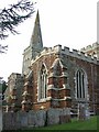

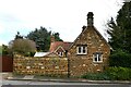

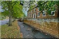
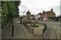
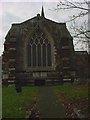
26 photos from this area
Area Information
Key information about the NN9 5LG including its size, population, and administrative classification.
- Area Type
- Postcode
- Area Size
- 1.9 hectares
- Population
- 1555
- Population Density
- 301 people/km²
House Prices in NN9 5LG
36
Properties
£217,941
Average Sold Price
£60,000
Lowest Price
£498,000
Highest Price
Showing 36 properties
| Address | Type | Beds | Baths | Last Sale Price | Last Sale Date | |
|---|---|---|---|---|---|---|
| 115 Wellingborough Road, Finedon, NN9 5LG | Detached | 4 | 1 | £282,500 | Jun 2025 | |
| 137 Wellingborough Road, Finedon, NN9 5LG | house | - | - | £498,000 | Jul 2021 | |
| 127 Wellingborough Road, Finedon, NN9 5LG | house | - | - | £174,950 | Jun 2021 | |
| 117 Wellingborough Road, Finedon, NN9 5LG | house | - | - | £345,000 | Nov 2020 | |
| 81 Wellingborough Road, Finedon, NN9 5LG | Terraced | 3 | 1 | £172,000 | Oct 2020 | |
| 75 Wellingborough Road, Finedon, NN9 5LG | Terraced | 2 | - | £174,000 | Aug 2020 | |
| 121 Wellingborough Road, Finedon, NN9 5LG | Terraced | 2 | 1 | £135,000 | Apr 2017 | |
| 135 Wellingborough Road, Finedon, NN9 5LG | Bungalow | 2 | 1 | £180,000 | Nov 2016 | |
| 73 Wellingborough Road, Finedon, NN9 5LG | Detached | 4 | 2 | £205,000 | Sep 2016 | |
| 79 Wellingborough Road, Finedon, NN9 5LG | Terraced | 3 | - | £146,000 | Apr 2016 |
Page 1 of 4
Energy Efficiency in NN9 5LG
Amenities
Schools
| Rank | School | Type | Entry gender | Ages |
|---|
Explore more schools in this area
Go to Schools tabDemographics
Household Size
One person
most common
Accommodation Type
Houses
most common
Tenure
56
majority
Ethnic Group
White
most common
Religion
N/A
most common
Household Composition
N/A
most common
Age
47
median
Adults (30-64 years)
most common
Household Deprivation
N/A
with no deprivation
NS-SEC
25
in Lower managerial occupations
Explore more demographic insights in this area
Go to Demographics tabPlanning
Planning Constraints
- Flood RiskPremium
- Ramsar Wetland SitesPremium
- Area of Outstanding Natural BeautyPremium
- Protected Nature ReservePremium
- Protected WoodlandPremium