Area Overview for NN8 7RY
Photos of NN8 7RY


Area Information
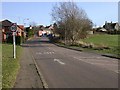
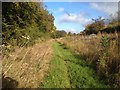
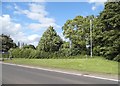
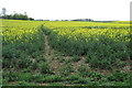
Living in NN8 7RY offers a quiet residential experience within a specific postcode cluster of just 2,474 people. You will find a low-density environment where the community feel remains close-knit yet peaceful. The area sits at a population density of 124 people per square kilometre, meaning streets are characterised by open space rather than high-rise blocks or crowded terraces. This small residential cluster provides a distinct break from the chaos of larger towns while maintaining essential local connections. You can anticipate a lifestyle defined by independence and a slower pace, suitable for those who prioritise a calm domestic setting over urban convenience. The housing stock reflects a settled community, with no major industrial or commercial disruption visible in the daily rhythm of the neighbourhood. When you look out your window, you are likely to see views of gardens and local green spaces rather than the hustle of a busy commercial high street. This makes NN8 7RY a practical choice for anyone seeking a slice of rural tranquillity that still connects effectively to the wider region. It is a place where daily life unfolds without the noise and crowds of a major city centre.
- Area Type
- Postcode
- Area Size
- Not available
- Population
- 2474
- Population Density
- 124 people/km²
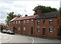
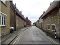
The property market in NN8 7RY is defined by stability and a strong presence of owner-occupiers. With 63% of residents owning their homes, the area functions primarily as an owner-occupied market rather than a transient rental sector. This dynamic creates a stable environment where property values tend to reflect the enduring appeal of the location to local families. Houses dominate the housing stock, meaning you will find detached or semi-detached dwellings rather than flats or high-density apartments. This concentration of houses supports a market where buyers often seek larger plots and traditional garden settings. Living in this postcode cluster means you are unlikely to encounter the volatility seen in student accommodation or investment-heavy urban markets. The residential cluster nature of NN8 7RY makes it attractive to families seeking privacy and space. You may find that the limited size of the area keeps competition moderate compared to larger districts, though demand can shift with transport links. The market here is rooted in the practical needs of settled households looking for a permanent home base.
House Prices in NN8 7RY
No properties found in this postcode.
Energy Efficiency in NN8 7RY
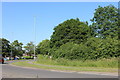
Your daily lifestyle in NN8 7RY centres on a convenient network of local amenities and reliable transport links. You can walk or drive to Co-op Wollaston and Co-op Irchester for your essential shopping needs, offering a range of groceries and daily essentials. Tesco Wellingborough remains a major retail destination nearby, accessible for larger shopping trips or weekly stock-ups. Transport links are straightforward, with Wellingborough Railway Station acting as your main rail hub for longer journeys beyond the immediate area. This station provides a practical connection to regional centres, ensuring you are not cut off from other parts of the country. The local amenities listed are within practical reach, meaning you will not need to travel far for basic conveniences. You will find a balance between the convenience of nearby shops and the peace of a residential setting. Dining options are limited to the supermarket food halls and local eateries associated with these retail centres. This setup creates a functional lifestyle where most errands are short and manageable.
Amenities
Schools
Families considering NN8 7RY will find a strong selection of primary education options within close proximity. Wollaston Community Primary School serves the local area as a key educational provider. Grendon Church of England Primary School also operates nearby and holds a good Ofsted rating. Wollaston Primary School is another well-regarded option for children in the neighbourhood, also carrying a good Ofsted rating. The concentration of primary schools indicates that the local catchment areas are designed to support young families living in this residential cluster. You will not find secondary schools listed for this specific cluster, so older children may need to travel further for their secondary education. This mix of school types ensures that younger pupils have accessible, high-quality options without long commutes. The presence of multiple primary choices provides flexibility for parents seeking a specific ethos, such as the Church of England environment offered by Grendon.
| Rank | School | Type | Entry gender | Ages |
|---|---|---|---|---|
| 1 | Wollaston Community Primary School | primary | N/A | N/A |
| 2 | Grendon Church of England Primary School | primary | N/A | N/A |
| 3 | Wollaston Primary School | primary | N/A | N/A |
Explore more schools in this area
Go to Schools tabDemographics
The community in NN8 7RY is overwhelmingly comprised of adults between the ages of 30 and 64 years old. The median age stands at 47 years, indicating a mature population that has likely built substantial roots in the locality. You are looking at an area where stability is a key demographic feature, with 63% of households in owner-occupied homes. This high rate of ownership suggests that many residents have chosen to put down roots for the long term rather than viewing their homes as short-term investments. Houses form the predominant accommodation type, reinforcing the character of a traditional, family-oriented neighbourhood. The demographic landscape is predominantly White, aligning with the historical settlement patterns of the region. You will find a community that understands the value of established local institutions and quiet neighbourly relations. This age profile often correlates with a demand for spacious homes and reliable local services rather than trendy entertainment venues. The settled nature of the population means you may notice long-standing friendships and a consistent sense of community across the years.
Household Size
Accommodation Type
Tenure
Ethnic Group
Religion
Household Composition
Age
Household Deprivation
NS-SEC
Explore more demographic insights in this area
Go to Demographics tabPlanning
Planning Constraints
- Flood RiskPremium
- Ramsar Wetland SitesPremium
- Area of Outstanding Natural BeautyPremium
- Protected Nature ReservePremium
- Protected WoodlandPremium
- Crime RiskPremium