Area Overview for NN8 5YH
Photos of NN8 5YH
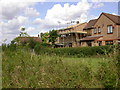
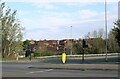
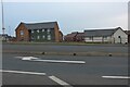
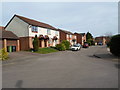
7 photos from this area
Area Information
Key information about the NN8 5YH including its size, population, and administrative classification.
- Area Type
- Postcode
- Area Size
- 8145 m²
- Population
- 1287
- Population Density
- 3618 people/km²
House Prices in NN8 5YH
26
Properties
£149,639
Average Sold Price
£43,000
Lowest Price
£335,000
Highest Price
Showing 26 properties
| Address | Type | Beds | Baths | Last Sale Price | Last Sale Date | |
|---|---|---|---|---|---|---|
| 22 Crawley Avenue, Wellingborough, NN8 5YH | Detached | 4 | 1 | £335,000 | Sep 2025 | |
| 10 Crawley Avenue, Wellingborough, NN8 5YH | Detached | 3 | 1 | £265,000 | Feb 2025 | |
| 9 Crawley Avenue, Wellingborough, NN8 5YH | Terraced | 3 | 1 | £197,500 | Sep 2021 | |
| 16 Crawley Avenue, Wellingborough, NN8 5YH | Semi-detached | 3 | 1 | £209,000 | Jun 2019 | |
| 25 Crawley Avenue, Wellingborough, NN8 5YH | Bungalow | 3 | 1 | £208,000 | Feb 2018 | |
| 7 Crawley Avenue, Wellingborough, NN8 5YH | Terraced | 3 | 1 | £148,000 | Feb 2016 | |
| 29 Crawley Avenue, Wellingborough, NN8 5YH | Bungalow | - | - | £142,000 | Jul 2011 | |
| 23 Crawley Avenue, Wellingborough, NN8 5YH | Bungalow | 2 | - | £106,000 | Mar 2011 | |
| 17 Crawley Avenue, Wellingborough, NN8 5YH | Bungalow | - | - | £153,000 | Dec 2009 | |
| 4 Crawley Avenue, Wellingborough, NN8 5YH | Semi-detached | - | - | £140,000 | Jul 2009 |
Page 1 of 3
Energy Efficiency in NN8 5YH
Amenities
Schools
| Rank | School | Type | Entry gender | Ages |
|---|
Explore more schools in this area
Go to Schools tabDemographics
Household Size
Family (3-5 people)
most common
Accommodation Type
Houses
most common
Tenure
92
majority
Ethnic Group
White
most common
Religion
N/A
most common
Household Composition
N/A
most common
Age
47
median
Adults (30-64 years)
most common
Household Deprivation
N/A
with no deprivation
NS-SEC
37
in Lower managerial occupations
Explore more demographic insights in this area
Go to Demographics tabPlanning
Planning Constraints
- Flood RiskPremium
- Ramsar Wetland SitesPremium
- Area of Outstanding Natural BeautyPremium
- Protected Nature ReservePremium
- Protected WoodlandPremium