Area Overview for NN8 2LZ
Photos of NN8 2LZ

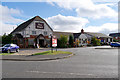
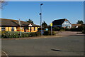
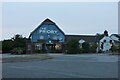
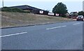
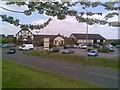
11 photos from this area
Area Information
Key information about the NN8 2LZ including its size, population, and administrative classification.
- Area Type
- Postcode
- Area Size
- 2.2 hectares
- Population
- 2137
- Population Density
- 1515 people/km²
House Prices in NN8 2LZ
26
Properties
£158,886
Average Sold Price
£72,000
Lowest Price
£305,000
Highest Price
Showing 26 properties
| Address | Type | Beds | Baths | Last Sale Price | Last Sale Date | |
|---|---|---|---|---|---|---|
| 169 Windsor Road, Wellingborough, NN8 2LZ | Semi-detached | 3 | 1 | £218,000 | Oct 2024 | |
| 165 Windsor Road, Wellingborough, NN8 2LZ | Retail | 3 | 1 | £225,000 | May 2022 | |
| 155 Windsor Road, Wellingborough, NN8 2LZ | house | - | - | £166,000 | Feb 2021 | |
| 142 Windsor Road, Wellingborough, NN8 2LZ | house | - | - | £305,000 | Aug 2020 | |
| 166 Windsor Road, Wellingborough, NN8 2LZ | Semi-detached | 3 | 1 | £178,000 | Oct 2019 | |
| 161 Windsor Road, Wellingborough, NN8 2LZ | Semi-detached | 3 | 1 | £182,000 | Aug 2019 | |
| 159 Windsor Road, Wellingborough, NN8 2LZ | Semi-detached | 3 | 1 | £102,750 | Feb 2011 | |
| 157 Windsor Road, Wellingborough, NN8 2LZ | Semi-detached | - | - | £97,995 | Oct 2008 | |
| 164 Windsor Road, Wellingborough, NN8 2LZ | house | 3 | - | £108,500 | May 2005 | |
| 168 Windsor Road, Wellingborough, NN8 2LZ | Semi-detached | - | - | £92,500 | Jan 2004 |
Page 1 of 3
Energy Efficiency in NN8 2LZ
Amenities
Schools
| Rank | School | Type | Entry gender | Ages |
|---|
Explore more schools in this area
Go to Schools tabDemographics
Household Size
Family (3-5 people)
most common
Accommodation Type
Houses
most common
Tenure
63
majority
Ethnic Group
White
most common
Religion
N/A
most common
Household Composition
N/A
most common
Age
47
median
Adults (30-64 years)
most common
Household Deprivation
N/A
with no deprivation
NS-SEC
24
in Lower managerial occupations
Explore more demographic insights in this area
Go to Demographics tabPlanning
Planning Constraints
- Flood RiskPremium
- Ramsar Wetland SitesPremium
- Area of Outstanding Natural BeautyPremium
- Protected Nature ReservePremium
- Protected WoodlandPremium