Area Overview for NN8 2EN
Photos of NN8 2EN
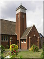
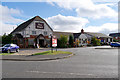
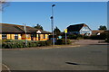
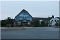
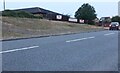
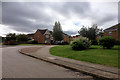
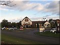
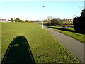
11 photos from this area
Area Information
Key information about the NN8 2EN including its size, population, and administrative classification.
- Area Type
- Postcode
- Area Size
- 4.7 hectares
- Population
- 1567
- Population Density
- 4030 people/km²
House Prices in NN8 2EN
17
Properties
£121,243
Average Sold Price
£44,000
Lowest Price
£235,000
Highest Price
Showing 17 properties
| Address | Type | Beds | Baths | Last Sale Price | Last Sale Date | |
|---|---|---|---|---|---|---|
| 100 Kingsway, Wellingborough, NN8 2EN | Semi-detached | 3 | 1 | £235,000 | Nov 2022 | |
| 110 Kingsway, Wellingborough, NN8 2EN | house | - | - | £225,000 | Aug 2021 | |
| 124 Kingsway, Wellingborough, NN8 2EN | Terraced | 3 | 1 | £166,950 | Nov 2016 | |
| 126 Kingsway, Wellingborough, NN8 2EN | house | - | - | £83,000 | Oct 2009 | |
| 122 Kingsway, Wellingborough, NN8 2EN | Terraced | - | - | £90,000 | Nov 2003 | |
| 116 Kingsway, Wellingborough, NN8 2EN | Semi-detached | 3 | 1 | £59,995 | Sep 2001 | |
| 98 Kingsway, Wellingborough, NN8 2EN | Semi-detached | - | - | £66,000 | Sep 2001 | |
| 112 Kingsway, Wellingborough, NN8 2EN | Semi-detached | - | - | £44,000 | Jul 1996 | |
| 102 Kingsway, Wellingborough, NN8 2EN | house | - | - | - | - | |
| 106 Kingsway, Wellingborough, NN8 2EN | Semi-detached | - | - | - | - |
Page 1 of 2
Energy Efficiency in NN8 2EN
Amenities
Schools
| Rank | School | Type | Entry gender | Ages |
|---|
Explore more schools in this area
Go to Schools tabDemographics
Household Size
Family (3-5 people)
most common
Accommodation Type
Houses
most common
Tenure
60
majority
Ethnic Group
White
most common
Religion
N/A
most common
Household Composition
N/A
most common
Age
47
median
Adults (30-64 years)
most common
Household Deprivation
N/A
with no deprivation
NS-SEC
23
in Lower managerial occupations
Explore more demographic insights in this area
Go to Demographics tabPlanning
Planning Constraints
- Flood RiskPremium
- Ramsar Wetland SitesPremium
- Area of Outstanding Natural BeautyPremium
- Protected Nature ReservePremium
- Protected WoodlandPremium