Area Overview for NN8 1NH
Photos of NN8 1NH
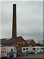
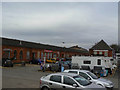
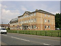
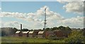
43 photos from this area
Area Information
Key information about the NN8 1NH including its size, population, and administrative classification.
- Area Type
- Postcode
- Area Size
- 1.2 hectares
- Population
- 1501
- Population Density
- 396 people/km²
House Prices in NN8 1NH
28
Properties
£136,674
Average Sold Price
£18,600
Lowest Price
£412,500
Highest Price
Showing 28 properties
| Address | Type | Beds | Baths | Last Sale Price | Last Sale Date | |
|---|---|---|---|---|---|---|
| 14 Senwick Road, Wellingborough, NN8 1NH | Terraced | 2 | 1 | £197,000 | Jun 2025 | |
| 38 Senwick Road, Wellingborough, NN8 1NH | Terraced | 3 | 1 | £190,000 | Jul 2021 | |
| 16 Senwick Road, Wellingborough, NN8 1NH | house | - | - | £170,000 | Jun 2021 | |
| 3 Senwick Road, Wellingborough, NN8 1NH | Terraced | 3 | 1 | £412,500 | Jun 2021 | |
| 30 Senwick Road, Wellingborough, NN8 1NH | Terraced | 2 | - | £168,500 | Jun 2021 | |
| 10 Senwick Road, Wellingborough, NN8 1NH | house | - | - | £157,000 | May 2021 | |
| 32 Senwick Road, Wellingborough, NN8 1NH | Terraced | - | - | £125,000 | Dec 2020 | |
| 20 Senwick Road, Wellingborough, NN8 1NH | house | - | - | £155,000 | Feb 2019 | |
| 8 Senwick Road, Wellingborough, NN8 1NH | Terraced | 2 | 1 | £149,950 | Jun 2017 | |
| 2 Senwick Road, Wellingborough, NN8 1NH | Terraced | 2 | 1 | £144,950 | Jan 2017 |
Page 1 of 3
Energy Efficiency in NN8 1NH
Amenities
Schools
| Rank | School | Type | Entry gender | Ages |
|---|
Explore more schools in this area
Go to Schools tabDemographics
Household Size
Two person
most common
Accommodation Type
Houses
most common
Tenure
57
majority
Ethnic Group
White
most common
Religion
N/A
most common
Household Composition
N/A
most common
Age
47
median
Adults (30-64 years)
most common
Household Deprivation
N/A
with no deprivation
NS-SEC
32
in Lower managerial occupations
Explore more demographic insights in this area
Go to Demographics tabPlanning
Planning Constraints
- Flood RiskPremium
- Ramsar Wetland SitesPremium
- Area of Outstanding Natural BeautyPremium
- Protected Nature ReservePremium
- Protected WoodlandPremium