Area Overview for NN8 1LT
Photos of NN8 1LT


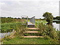
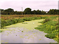
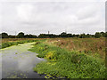

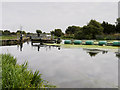

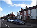
43 photos from this area
Area Information
Key information about the NN8 1LT including its size, population, and administrative classification.
- Area Type
- Postcode
- Area Size
- 3.1 hectares
- Population
- 2202
- Population Density
- 5221 people/km²
House Prices in NN8 1LT
24
Properties
£132,305
Average Sold Price
£27,000
Lowest Price
£275,000
Highest Price
Showing 24 properties
| Address | Type | Beds | Baths | Last Sale Price | Last Sale Date | |
|---|---|---|---|---|---|---|
| 10 Irthlingborough Road, Wellingborough, NN8 1LT | house | - | - | £244,000 | Aug 2024 | |
| 38 Irthlingborough Road, Wellingborough, NN8 1LT | Flat | 1 | 1 | £51,750 | Nov 2022 | |
| 6 Irthlingborough Road, Wellingborough, NN8 1LT | Terraced | 3 | 2 | £275,000 | Oct 2022 | |
| 42 Irthlingborough Road, Wellingborough, NN8 1LT | Flat | 2 | 1 | £120,000 | Sep 2018 | |
| 14 Irthlingborough Road, Wellingborough, NN8 1LT | house | 4 | - | £185,000 | Nov 2010 | |
| 36 Irthlingborough Road, Wellingborough, NN8 1LT | Flat | - | - | £27,000 | Jan 2010 | |
| 30 Irthlingborough Road, Wellingborough, NN8 1LT | Flat | 2 | 1 | £30,400 | Feb 2009 | |
| 8 Irthlingborough Road, Wellingborough, NN8 1LT | Terraced | 3 | 1 | £179,950 | Jul 2007 | |
| 12 Irthlingborough Road, Wellingborough, NN8 1LT | Terraced | 3 | 2 | £160,000 | Apr 2007 | |
| 2 Irthlingborough Road, Wellingborough, NN8 1LT | Semi-detached | - | - | £49,950 | Oct 1998 |
Page 1 of 3
Energy Efficiency in NN8 1LT
Amenities
Schools
| Rank | School | Type | Entry gender | Ages |
|---|
Explore more schools in this area
Go to Schools tabDemographics
Household Size
Family (3-5 people)
most common
Accommodation Type
Houses
most common
Tenure
48
majority
Ethnic Group
White
most common
Religion
N/A
most common
Household Composition
N/A
most common
Age
47
median
Adults (30-64 years)
most common
Household Deprivation
N/A
with no deprivation
NS-SEC
25
in Lower managerial occupations
Explore more demographic insights in this area
Go to Demographics tabPlanning
Planning Constraints
- Flood RiskPremium
- Ramsar Wetland SitesPremium
- Area of Outstanding Natural BeautyPremium
- Protected Nature ReservePremium
- Protected WoodlandPremium