Area Overview for NN7 4LB
Photos of NN7 4LB


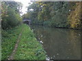
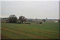
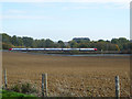

41 photos from this area
Area Information
Key information about the NN7 4LB including its size, population, and administrative classification.
- Area Type
- Postcode
- Area Size
- 2.6 km²
- Population
- 2195
- Population Density
- 71 people/km²
House Prices in NN7 4LB
46
Properties
£1,262,500
Average Sold Price
£325,000
Lowest Price
£2,200,000
Highest Price
Showing 46 properties
| Address | Type | Beds | Baths | Last Sale Price | Last Sale Date | |
|---|---|---|---|---|---|---|
| Dial House, Watling Street, Weedon, NN7 4LB | Cottage | 2 | - | £325,000 | Apr 2019 | |
| Woodyard Cottage, Watling Street, Brockhall, NN7 4LB | Detached | 3 | - | £2,200,000 | Aug 2017 | |
| Ivy House Farm, Watling Street, Weedon, NN7 4LB | Detached | - | - | - | - | |
| Watling Meadow Farm, Watling Street, Weedon, NN7 4LB | Mobile Home | 2 | 1 | - | - | |
| Unit 15 Main Building, Heart Of The Shires Shopping Village, Watling Street, Norton, NN7 4LB | Retail | - | - | - | - | |
| Margo & Evie, Unit 4 The Barn, Heart Of The Shires Shopping Village, Watling Street, Norton, NN7 4LB | retail_financial | - | - | - | - | |
| Unit 23 Main Building, Heart Of The Shires Shopping Village, Watling Street, Norton, NN7 4LB | Retail | - | - | - | - | |
| Unit 20 Main Building, Heart Of The Shires Shopping Village, Watling Street, Norton, NN7 4LB | shop | - | - | - | - | |
| Unit 2 The Barn, Heart Of The Shires Shopping Village, Watling Street, Norton, NN7 4LB | retail_financial | - | - | - | - | |
| Margo & Evie, Unit 6 The Barn, Heart Of The Shires Shopping Village, Watling Street, Norton, NN7 4LB | retail_financial | - | - | - | - |
Page 1 of 5
Energy Efficiency in NN7 4LB
Amenities
Schools
| Rank | School | Type | Entry gender | Ages |
|---|
Explore more schools in this area
Go to Schools tabDemographics
Household Size
Two person
most common
Accommodation Type
Houses
most common
Tenure
80
majority
Ethnic Group
White
most common
Religion
N/A
most common
Household Composition
N/A
most common
Age
47
median
Adults (30-64 years)
most common
Household Deprivation
N/A
with no deprivation
NS-SEC
44
in Lower managerial occupations
Explore more demographic insights in this area
Go to Demographics tabPlanning
Planning Constraints
- Flood RiskPremium
- Ramsar Wetland SitesPremium
- Area of Outstanding Natural BeautyPremium
- Protected Nature ReservePremium
- Protected WoodlandPremium