Area Overview for NN7 4DX
Photos of NN7 4DX

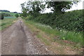
2 photos from this area
Area Information
Key information about the NN7 4DX including its size, population, and administrative classification.
- Area Type
- Postcode
- Area Size
- 2.9 km²
- Population
- 2195
- Population Density
- 71 people/km²
House Prices in NN7 4DX
21
Properties
£531,250
Average Sold Price
£330,000
Lowest Price
£885,000
Highest Price
Showing 21 properties
| Address | Type | Beds | Baths | Last Sale Price | Last Sale Date | |
|---|---|---|---|---|---|---|
| 25 Glassthorpe Lane, Harpole, NN7 4DX | Detached | 5 | 3 | £780,000 | Nov 2024 | |
| 31 Glassthorpe Lane, Harpole, NN7 4DX | Detached | 4 | 2 | £680,000 | Aug 2024 | |
| 29 Glassthorpe Lane, Harpole, NN7 4DX | house | - | - | £885,000 | Mar 2024 | |
| 35 Glassthorpe Lane, Harpole, NN7 4DX | Retail | 3 | 2 | £475,000 | Dec 2022 | |
| 9 Glassthorpe Lane, Harpole, NN7 4DX | Semi-detached | 3 | 1 | £332,500 | Dec 2021 | |
| Squints Corner, 21 Glassthorpe Lane, Harpole, NN7 4DX | Semi-detached | 3 | - | £410,000 | Oct 2019 | |
| 19 Glassthorpe Lane, Harpole, NN7 4DX | house | - | - | £330,000 | Feb 2017 | |
| The Old Chapel, 23 Glassthorpe Lane, Harpole, NN7 4DX | Detached | - | - | £410,000 | Apr 2015 | |
| 33 Glassthorpe Lane, Harpole, NN7 4DX | house | - | - | £465,000 | May 2014 | |
| Meadow View, 39 Glassthorpe Lane, Harpole, NN7 4DX | house | - | - | £545,000 | Apr 2014 |
Page 1 of 3
Energy Efficiency in NN7 4DX
Amenities
Schools
| Rank | School | Type | Entry gender | Ages |
|---|
Explore more schools in this area
Go to Schools tabDemographics
Household Size
Two person
most common
Accommodation Type
Houses
most common
Tenure
80
majority
Ethnic Group
White
most common
Religion
N/A
most common
Household Composition
N/A
most common
Age
47
median
Adults (30-64 years)
most common
Household Deprivation
N/A
with no deprivation
NS-SEC
44
in Lower managerial occupations
Explore more demographic insights in this area
Go to Demographics tabPlanning
Planning Constraints
- Flood RiskPremium
- Ramsar Wetland SitesPremium
- Area of Outstanding Natural BeautyPremium
- Protected Nature ReservePremium
- Protected WoodlandPremium