Area Overview for NN7 3DL
Photos of NN7 3DL
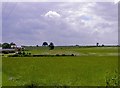
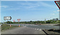

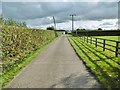
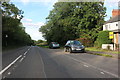
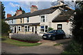
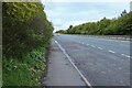

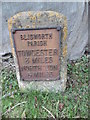
13 photos from this area
Area Information
Key information about the NN7 3DL including its size, population, and administrative classification.
- Area Type
- Postcode
- Area Size
- 91.7 hectares
- Population
- 1851
- Population Density
- 243 people/km²
House Prices in NN7 3DL
13
Properties
£415,714
Average Sold Price
£150,000
Lowest Price
£1,128,000
Highest Price
Showing 13 properties
| Address | Type | Beds | Baths | Last Sale Price | Last Sale Date | |
|---|---|---|---|---|---|---|
| 19 Towcester Road, Blisworth, NN7 3DL | Terraced | 2 | 1 | £210,000 | Feb 2022 | |
| 35 Towcester Road, Blisworth, NN7 3DL | Detached | 5 | - | £790,000 | Mar 2021 | |
| Pynus Cottage, 21 Towcester Road, Blisworth, NN7 3DL | house | - | - | £209,000 | Jan 2021 | |
| 25 Towcester Road, Blisworth, NN7 3DL | Terraced | 2 | 1 | £215,000 | Nov 2018 | |
| Oakwood Farm House, Towcester Road, Blisworth, NN7 3DL | house | - | - | £1,128,000 | Jul 2018 | |
| 33 Towcester Road, Blisworth, NN7 3DL | house | - | - | £208,000 | Jun 2015 | |
| 23 Towcester Road, Blisworth, NN7 3DL | Terraced | - | - | £150,000 | Feb 2007 | |
| 27 Towcester Road, Blisworth, NN7 3DL | Semi-detached | - | - | - | - | |
| 17 Towcester Road, Blisworth, NN7 3DL | Semi-detached | - | - | - | - | |
| 31 Towcester Road, Blisworth, NN7 3DL | Semi-detached | - | - | - | - |
Page 1 of 2
Energy Efficiency in NN7 3DL
Amenities
Schools
| Rank | School | Type | Entry gender | Ages |
|---|
Explore more schools in this area
Go to Schools tabDemographics
Household Size
Two person
most common
Accommodation Type
Houses
most common
Tenure
75
majority
Ethnic Group
White
most common
Religion
N/A
most common
Household Composition
N/A
most common
Age
47
median
Adults (30-64 years)
most common
Household Deprivation
N/A
with no deprivation
NS-SEC
36
in Lower managerial occupations
Explore more demographic insights in this area
Go to Demographics tabPlanning
Planning Constraints
- Flood RiskPremium
- Ramsar Wetland SitesPremium
- Area of Outstanding Natural BeautyPremium
- Protected Nature ReservePremium
- Protected WoodlandPremium