Area Overview for NN7 2HP
Photos of NN7 2HP
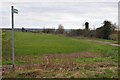
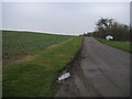
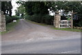
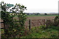
4 photos from this area
Area Information
Key information about the NN7 2HP including its size, population, and administrative classification.
- Area Type
- Postcode
- Area Size
- 32.7 hectares
- Population
- 2028
- Population Density
- 224 people/km²
House Prices in NN7 2HP
55
Properties
£380,080
Average Sold Price
£119,000
Lowest Price
£625,000
Highest Price
Showing 55 properties
| Address | Type | Beds | Baths | Last Sale Price | Last Sale Date | |
|---|---|---|---|---|---|---|
| 50 Park Road, Hartwell, NN7 2HP | Detached | 3 | 1 | £440,000 | Nov 2025 | |
| 37 Park Road, Hartwell, NN7 2HP | Detached | 3 | 1 | £460,000 | Mar 2024 | |
| Highfield, 63 Park Road, Hartwell, NN7 2HP | house | - | - | £475,000 | Mar 2024 | |
| 43 Park Road, Hartwell, NN7 2HP | Detached | 4 | 2 | £625,000 | May 2023 | |
| 66 Park Road, Hartwell, NN7 2HP | Bungalow | - | - | £575,000 | Mar 2023 | |
| 45 Park Road, Hartwell, NN7 2HP | house | - | - | £214,000 | Jul 2021 | |
| 62 Park Road, Hartwell, NN7 2HP | Bungalow | 3 | 2 | £575,000 | Jun 2021 | |
| 28 Park Road, Hartwell, NN7 2HP | Detached | 5 | 4 | £465,000 | Mar 2021 | |
| 33 Park Road, Hartwell, NN7 2HP | Detached | 4 | 4 | £430,000 | Sep 2020 | |
| Whitecroft, 65 Park Road, Hartwell, NN7 2HP | Detached | 3 | 2 | £395,000 | May 2019 |
Page 1 of 6
Energy Efficiency in NN7 2HP
Amenities
Schools
| Rank | School | Type | Entry gender | Ages |
|---|
Explore more schools in this area
Go to Schools tabDemographics
Household Size
Family (3-5 people)
most common
Accommodation Type
Houses
most common
Tenure
83
majority
Ethnic Group
White
most common
Religion
N/A
most common
Household Composition
N/A
most common
Age
47
median
Adults (30-64 years)
most common
Household Deprivation
N/A
with no deprivation
NS-SEC
41
in Lower managerial occupations
Explore more demographic insights in this area
Go to Demographics tabPlanning
Planning Constraints
- Flood RiskPremium
- Ramsar Wetland SitesPremium
- Area of Outstanding Natural BeautyPremium
- Protected Nature ReservePremium
- Protected WoodlandPremium