Area Overview for NN6 7RB
Photos of NN6 7RB
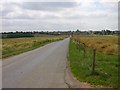
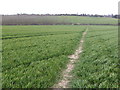
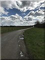
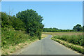
4 photos from this area
Area Information
Key information about the NN6 7RB including its size, population, and administrative classification.
- Area Type
- Postcode
- Area Size
- 22.9 hectares
- Population
- 1409
- Population Density
- 652 people/km²
House Prices in NN6 7RB
54
Properties
£317,800
Average Sold Price
£50,000
Lowest Price
£590,000
Highest Price
Showing 54 properties
| Address | Type | Beds | Baths | Last Sale Price | Last Sale Date | |
|---|---|---|---|---|---|---|
| 49 East Street, Long Buckby, NN6 7RB | Terraced | 2 | 1 | £225,000 | Jun 2025 | |
| 41 East Street, Long Buckby, NN6 7RB | Detached | 3 | 1 | £437,500 | Feb 2024 | |
| Silver Birch, 17 East Street, Long Buckby, NN6 7RB | Detached | 4 | 2 | £460,000 | Nov 2023 | |
| 35 East Street, Long Buckby, NN6 7RB | house | 3 | - | £345,000 | Dec 2021 | |
| Lady Close House, 29 East Street, Long Buckby, NN6 7RB | house | - | - | £548,000 | Sep 2021 | |
| 95 East Street, Long Buckby, NN6 7RB | Detached | 3 | - | £315,000 | Mar 2021 | |
| The Cedars, 39 East Street, Long Buckby, NN6 7RB | Bungalow | - | - | £400,000 | Oct 2020 | |
| 63 East Street, Long Buckby, NN6 7RB | Detached | 4 | 2 | £382,000 | Nov 2019 | |
| 79 East Street, Long Buckby, NN6 7RB | Detached | 5 | - | £535,000 | Sep 2019 | |
| Highway, 31 East Street, Long Buckby, NN6 7RB | house | - | - | £300,000 | Aug 2019 |
Page 1 of 6
Energy Efficiency in NN6 7RB
Amenities
Schools
| Rank | School | Type | Entry gender | Ages |
|---|
Explore more schools in this area
Go to Schools tabDemographics
Household Size
Two person
most common
Accommodation Type
Houses
most common
Tenure
89
majority
Ethnic Group
White
most common
Religion
N/A
most common
Household Composition
N/A
most common
Age
47
median
Adults (30-64 years)
most common
Household Deprivation
N/A
with no deprivation
NS-SEC
43
in Lower managerial occupations
Explore more demographic insights in this area
Go to Demographics tabPlanning
Planning Constraints
- Flood RiskPremium
- Ramsar Wetland SitesPremium
- Area of Outstanding Natural BeautyPremium
- Protected Nature ReservePremium
- Protected WoodlandPremium