Area Overview for NN6 7AF
Photos of NN6 7AF
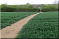
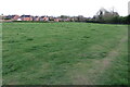
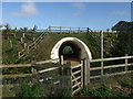
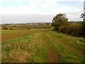
9 photos from this area
Area Information
Key information about the NN6 7AF including its size, population, and administrative classification.
- Area Type
- Postcode
- Area Size
- 2.7 hectares
- Population
- 2717
- Population Density
- 136 people/km²
House Prices in NN6 7AF
56
Properties
£205,947
Average Sold Price
£85,000
Lowest Price
£315,000
Highest Price
Showing 56 properties
| Address | Type | Beds | Baths | Last Sale Price | Last Sale Date | |
|---|---|---|---|---|---|---|
| 19 Elizabeth Road, West Haddon, NN6 7AF | Retail | 3 | 1 | £315,000 | Sep 2025 | |
| 64 Elizabeth Road, West Haddon, NN6 7AF | Semi-detached | 3 | 1 | £295,000 | Dec 2024 | |
| 6 Elizabeth Road, West Haddon, NN6 7AF | Semi-detached | 3 | 1 | £279,000 | Aug 2024 | |
| 31 Elizabeth Road, West Haddon, NN6 7AF | Semi-detached | 3 | 1 | £254,000 | Nov 2023 | |
| 16 Elizabeth Road, West Haddon, NN6 7AF | Semi-detached | 3 | 1 | £220,000 | Oct 2023 | |
| 5 Elizabeth Road, West Haddon, NN6 7AF | Semi-detached | 3 | 1 | £245,000 | Aug 2021 | |
| 25 Elizabeth Road, West Haddon, NN6 7AF | house | - | - | £265,000 | Nov 2020 | |
| 12 Elizabeth Road, West Haddon, NN6 7AF | Semi-detached | 3 | 1 | £227,000 | Nov 2018 | |
| 14 Elizabeth Road, West Haddon, NN6 7AF | Semi-detached | 3 | - | £170,000 | Oct 2016 | |
| 4 Elizabeth Road, West Haddon, NN6 7AF | Semi-detached | 3 | - | £190,000 | Jun 2016 |
Page 1 of 6
Energy Efficiency in NN6 7AF
Amenities
Schools
| Rank | School | Type | Entry gender | Ages |
|---|
Explore more schools in this area
Go to Schools tabDemographics
Household Size
Family (3-5 people)
most common
Accommodation Type
Houses
most common
Tenure
75
majority
Ethnic Group
White
most common
Religion
N/A
most common
Household Composition
N/A
most common
Age
47
median
Adults (30-64 years)
most common
Household Deprivation
N/A
with no deprivation
NS-SEC
46
in Lower managerial occupations
Explore more demographic insights in this area
Go to Demographics tabPlanning
Planning Constraints
- Flood RiskPremium
- Ramsar Wetland SitesPremium
- Area of Outstanding Natural BeautyPremium
- Protected Nature ReservePremium
- Protected WoodlandPremium