Area Overview for NN6 0FX
Photos of NN6 0FX
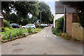
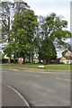

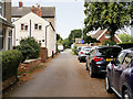
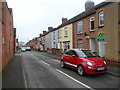
5 photos from this area
Area Information
Key information about the NN6 0FX including its size, population, and administrative classification.
- Area Type
- Postcode
- Area Size
- 2.5 hectares
- Population
- 2058
- Population Density
- 815 people/km²
House Prices in NN6 0FX
45
Properties
£370,667
Average Sold Price
£229,079
Lowest Price
£580,000
Highest Price
Showing 45 properties
| Address | Type | Beds | Baths | Last Sale Price | Last Sale Date | |
|---|---|---|---|---|---|---|
| 52 Morby Road, Earls Barton, NN6 0FX | house | - | - | £580,000 | Jan 2024 | |
| 42 Morby Road, Earls Barton, NN6 0FX | Terraced | 3 | 2 | £309,995 | Aug 2023 | |
| 50 Morby Road, Earls Barton, NN6 0FX | house | 4 | 2 | £427,496 | Jul 2023 | |
| 44 Morby Road, Earls Barton, NN6 0FX | house | - | - | £329,995 | Jul 2023 | |
| 32 Morby Road, Earls Barton, NN6 0FX | Terraced | 3 | 2 | £341,995 | Jun 2023 | |
| 34 Morby Road, Earls Barton, NN6 0FX | house | - | - | £346,995 | Jun 2023 | |
| 36 Morby Road, Earls Barton, NN6 0FX | house | - | - | £299,245 | Jun 2023 | |
| 40 Morby Road, Earls Barton, NN6 0FX | house | - | - | £308,745 | May 2023 | |
| 38 Morby Road, Earls Barton, NN6 0FX | house | - | - | £314,995 | May 2023 | |
| 46 Morby Road, Earls Barton, NN6 0FX | house | - | - | £460,995 | Apr 2023 |
Page 1 of 5
Energy Efficiency in NN6 0FX
Amenities
Schools
| Rank | School | Type | Entry gender | Ages |
|---|
Explore more schools in this area
Go to Schools tabDemographics
Household Size
Family (3-5 people)
most common
Accommodation Type
Houses
most common
Tenure
75
majority
Ethnic Group
White
most common
Religion
N/A
most common
Household Composition
N/A
most common
Age
47
median
Adults (30-64 years)
most common
Household Deprivation
N/A
with no deprivation
NS-SEC
39
in Lower managerial occupations
Explore more demographic insights in this area
Go to Demographics tabPlanning
Planning Constraints
- Flood RiskPremium
- Ramsar Wetland SitesPremium
- Area of Outstanding Natural BeautyPremium
- Protected Nature ReservePremium
- Protected WoodlandPremium