Area Overview for NN6 0EJ
Photos of NN6 0EJ
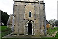
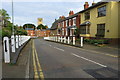
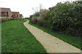
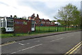
42 photos from this area
Area Information
Key information about the NN6 0EJ including its size, population, and administrative classification.
- Area Type
- Postcode
- Area Size
- 8610 m²
- Population
- 1914
- Population Density
- 623 people/km²
House Prices in NN6 0EJ
28
Properties
£162,533
Average Sold Price
£53,000
Lowest Price
£275,000
Highest Price
Showing 28 properties
| Address | Type | Beds | Baths | Last Sale Price | Last Sale Date | |
|---|---|---|---|---|---|---|
| 19 Park Close, Earls Barton, NN6 0EJ | Semi-detached | 2 | 1 | £255,000 | Sep 2025 | |
| 17 Park Close, Earls Barton, NN6 0EJ | house | - | - | £225,000 | Jul 2024 | |
| 14 Park Close, Earls Barton, NN6 0EJ | Semi-detached | 2 | 1 | £250,000 | Mar 2024 | |
| 16 Park Close, Earls Barton, NN6 0EJ | Semi-detached | 2 | 1 | £230,000 | Sep 2023 | |
| 12 Park Close, Earls Barton, NN6 0EJ | Semi-detached | 3 | 1 | £275,000 | Dec 2022 | |
| 18 Park Close, Earls Barton, NN6 0EJ | Semi-detached | 2 | 1 | £185,000 | Dec 2020 | |
| 24 Park Close, Earls Barton, NN6 0EJ | house | - | - | £230,000 | Dec 2020 | |
| 26 Park Close, Earls Barton, NN6 0EJ | Terraced | 2 | - | £185,000 | Oct 2019 | |
| 7 Park Close, Earls Barton, NN6 0EJ | Semi-detached | 2 | 1 | £194,000 | Sep 2018 | |
| 25 Park Close, Earls Barton, NN6 0EJ | Terraced | 2 | - | £204,995 | Aug 2018 |
Page 1 of 3
Energy Efficiency in NN6 0EJ
Amenities
Schools
| Rank | School | Type | Entry gender | Ages |
|---|
Explore more schools in this area
Go to Schools tabDemographics
Household Size
Two person
most common
Accommodation Type
Houses
most common
Tenure
76
majority
Ethnic Group
White
most common
Religion
N/A
most common
Household Composition
N/A
most common
Age
47
median
Adults (30-64 years)
most common
Household Deprivation
N/A
with no deprivation
NS-SEC
39
in Lower managerial occupations
Explore more demographic insights in this area
Go to Demographics tabPlanning
Planning Constraints
- Flood RiskPremium
- Ramsar Wetland SitesPremium
- Area of Outstanding Natural BeautyPremium
- Protected Nature ReservePremium
- Protected WoodlandPremium