Area Overview for NN5 6XP
Photos of NN5 6XP
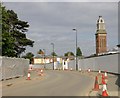
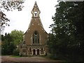
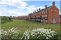
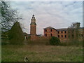
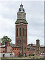
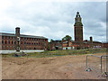
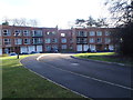

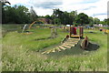
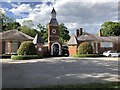
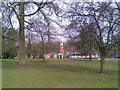
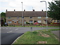
22 photos from this area
Area Information
Key information about the NN5 6XP including its size, population, and administrative classification.
- Area Type
- Postcode
- Area Size
- 3.8 hectares
- Population
- 1389
- Population Density
- 5351 people/km²
House Prices in NN5 6XP
86
Properties
£193,295
Average Sold Price
£13,000
Lowest Price
£307,000
Highest Price
Showing 86 properties
| Address | Type | Beds | Baths | Last Sale Price | Last Sale Date | |
|---|---|---|---|---|---|---|
| 19 Prestbury Road, Northampton, NN5 6XP | Detached | 3 | 2 | £307,000 | Aug 2025 | |
| 25 Prestbury Road, Northampton, NN5 6XP | Semi-detached | 3 | 1 | £249,000 | Aug 2024 | |
| 1A Prestbury Road, Northampton, NN5 6XP | house | - | - | £290,000 | Jun 2023 | |
| 1 Prestbury Road, Northampton, NN5 6XP | house | 3 | 2 | £260,000 | Nov 2022 | |
| 81 Prestbury Road, Northampton, NN5 6XP | Semi-detached | 3 | 2 | £280,000 | Aug 2022 | |
| 89 Prestbury Road, Northampton, NN5 6XP | Detached | 3 | - | £270,000 | Aug 2021 | |
| 16 Prestbury Road, Northampton, NN5 6XP | house | - | - | £255,000 | Apr 2021 | |
| 24 Prestbury Road, Northampton, NN5 6XP | Semi-detached | 3 | 1 | £245,000 | May 2020 | |
| 69 Prestbury Road, Northampton, NN5 6XP | Semi-detached | 3 | 2 | £227,000 | Feb 2019 | |
| 8 Prestbury Road, Northampton, NN5 6XP | house | 3 | - | £199,452 | Oct 2012 |
Page 1 of 9
Energy Efficiency in NN5 6XP
Amenities
Schools
| Rank | School | Type | Entry gender | Ages |
|---|
Explore more schools in this area
Go to Schools tabDemographics
Household Size
Two person
most common
Accommodation Type
Houses
most common
Tenure
91
majority
Ethnic Group
White
most common
Religion
N/A
most common
Household Composition
N/A
most common
Age
47
median
Adults (30-64 years)
most common
Household Deprivation
N/A
with no deprivation
NS-SEC
31
in Lower managerial occupations
Explore more demographic insights in this area
Go to Demographics tabPlanning
Planning Constraints
- Flood RiskPremium
- Ramsar Wetland SitesPremium
- Area of Outstanding Natural BeautyPremium
- Protected Nature ReservePremium
- Protected WoodlandPremium