Area Overview for NN5 6SL
Photos of NN5 6SL
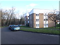
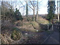
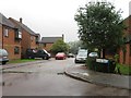
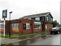
14 photos from this area
Area Information
Key information about the NN5 6SL including its size, population, and administrative classification.
- Area Type
- Postcode
- Area Size
- 1.2 hectares
- Population
- 1188
- Population Density
- 5671 people/km²
House Prices in NN5 6SL
33
Properties
£166,050
Average Sold Price
£72,000
Lowest Price
£332,500
Highest Price
Showing 33 properties
| Address | Type | Beds | Baths | Last Sale Price | Last Sale Date | |
|---|---|---|---|---|---|---|
| 66 Whitefield Road, Northampton, NN5 6SL | Retail | 3 | 1 | £295,000 | Jul 2023 | |
| 58 Whitefield Road, Northampton, NN5 6SL | house | - | - | £332,500 | Nov 2020 | |
| 26 Whitefield Road, Northampton, NN5 6SL | Semi-detached | 4 | - | £200,000 | Mar 2017 | |
| 40 Whitefield Road, Northampton, NN5 6SL | Semi-detached | 3 | - | £200,000 | Aug 2016 | |
| 10 Whitefield Road, Northampton, NN5 6SL | Semi-detached | 3 | - | £175,000 | Sep 2013 | |
| 50 Whitefield Road, Northampton, NN5 6SL | house | - | - | £171,000 | Jul 2013 | |
| 56 Whitefield Road, Northampton, NN5 6SL | Semi-detached | 4 | 1 | £164,950 | Jun 2013 | |
| 4 Whitefield Road, Northampton, NN5 6SL | house | - | - | £154,000 | May 2012 | |
| 42 Whitefield Road, Northampton, NN5 6SL | house | 3 | - | £145,500 | Dec 2011 | |
| 8 Whitefield Road, Northampton, NN5 6SL | house | - | - | £151,000 | Oct 2009 |
Page 1 of 4
Energy Efficiency in NN5 6SL
Amenities
Schools
| Rank | School | Type | Entry gender | Ages |
|---|
Explore more schools in this area
Go to Schools tabDemographics
Household Size
Family (3-5 people)
most common
Accommodation Type
Houses
most common
Tenure
80
majority
Ethnic Group
White
most common
Religion
N/A
most common
Household Composition
N/A
most common
Age
47
median
Adults (30-64 years)
most common
Household Deprivation
N/A
with no deprivation
NS-SEC
31
in Lower managerial occupations
Explore more demographic insights in this area
Go to Demographics tabPlanning
Planning Constraints
- Flood RiskPremium
- Ramsar Wetland SitesPremium
- Area of Outstanding Natural BeautyPremium
- Protected Nature ReservePremium
- Protected WoodlandPremium