Area Overview for NN5 6GJ
Photos of NN5 6GJ
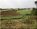


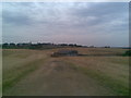
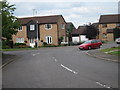
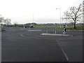
10 photos from this area
Area Information
Key information about the NN5 6GJ including its size, population, and administrative classification.
- Area Type
- Postcode
- Area Size
- 2.2 hectares
- Population
- 1895
- Population Density
- 3886 people/km²
House Prices in NN5 6GJ
18
Properties
£265,819
Average Sold Price
£171,000
Lowest Price
£442,500
Highest Price
Showing 18 properties
| Address | Type | Beds | Baths | Last Sale Price | Last Sale Date | |
|---|---|---|---|---|---|---|
| 4 Roundwood Way, Northampton, NN5 6GJ | Semi-detached | 3 | 2 | £300,000 | Aug 2024 | |
| 7 Roundwood Way, Northampton, NN5 6GJ | Retail | 4 | 2 | £442,500 | Dec 2022 | |
| 17 Roundwood Way, Northampton, NN5 6GJ | house | - | - | £240,000 | Jun 2017 | |
| 20 Roundwood Way, Northampton, NN5 6GJ | Terraced | 3 | 1 | £210,000 | Oct 2015 | |
| 18 Roundwood Way, Northampton, NN5 6GJ | Semi-detached | 3 | 2 | £210,000 | Sep 2015 | |
| 2 Roundwood Way, Northampton, NN5 6GJ | Semi-detached | 1 | 3 | £244,250 | Dec 2014 | |
| 16 Roundwood Way, Northampton, NN5 6GJ | house | - | - | £250,000 | Mar 2008 | |
| 10 Roundwood Way, Northampton, NN5 6GJ | Semi-detached | 3 | 2 | £324,624 | Jun 2005 | |
| 15 Roundwood Way, Northampton, NN5 6GJ | Terraced | - | - | £171,000 | Jun 2004 | |
| 3 Roundwood Way, Northampton, NN5 6GJ | Terraced | 3 | 1 | - | - |
Page 1 of 2
Energy Efficiency in NN5 6GJ
Amenities
Schools
| Rank | School | Type | Entry gender | Ages |
|---|
Explore more schools in this area
Go to Schools tabDemographics
Household Size
Family (3-5 people)
most common
Accommodation Type
Houses
most common
Tenure
71
majority
Ethnic Group
White
most common
Religion
N/A
most common
Household Composition
N/A
most common
Age
47
median
Adults (30-64 years)
most common
Household Deprivation
N/A
with no deprivation
NS-SEC
43
in Lower managerial occupations
Explore more demographic insights in this area
Go to Demographics tabPlanning
Planning Constraints
- Flood RiskPremium
- Ramsar Wetland SitesPremium
- Area of Outstanding Natural BeautyPremium
- Protected Nature ReservePremium
- Protected WoodlandPremium