Area Overview for NN4 9YP
Photos of NN4 9YP
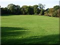

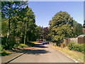
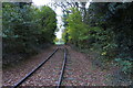
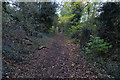

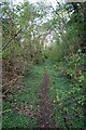
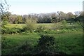
46 photos from this area
Area Information
Key information about the NN4 9YP including its size, population, and administrative classification.
- Area Type
- Postcode
- Area Size
- 2.5 hectares
- Population
- 1827
- Population Density
- 1621 people/km²
House Prices in NN4 9YP
35
Properties
£201,251
Average Sold Price
£6,000
Lowest Price
£460,000
Highest Price
Showing 35 properties
| Address | Type | Beds | Baths | Last Sale Price | Last Sale Date | |
|---|---|---|---|---|---|---|
| 7 Hawkridge, Northampton, NN4 9YP | Bungalow | 3 | 2 | £425,000 | Jul 2024 | |
| 23 Hawkridge, Northampton, NN4 9YP | Detached | 4 | 2 | £460,000 | Mar 2024 | |
| 20 Hawkridge, Northampton, NN4 9YP | Detached | 3 | 1 | £280,000 | Feb 2024 | |
| 17 Hawkridge, Northampton, NN4 9YP | house | - | - | £278,000 | Dec 2022 | |
| 33 Hawkridge, Northampton, NN4 9YP | Bungalow | 3 | 2 | £370,500 | Aug 2022 | |
| 2 Hawkridge, Northampton, NN4 9YP | house | 3 | - | £265,000 | May 2022 | |
| 14 Hawkridge, Northampton, NN4 9YP | Detached | 3 | 1 | £275,000 | Jan 2022 | |
| 6 Hawkridge, Northampton, NN4 9YP | Bungalow | - | - | £340,000 | Dec 2020 | |
| 10 Hawkridge, Northampton, NN4 9YP | house | - | - | £215,000 | Jun 2020 | |
| 25 Hawkridge, Northampton, NN4 9YP | Detached | 4 | - | £342,500 | Nov 2018 |
Page 1 of 4
Energy Efficiency in NN4 9YP
Amenities
Schools
| Rank | School | Type | Entry gender | Ages |
|---|
Explore more schools in this area
Go to Schools tabDemographics
Household Size
Family (3-5 people)
most common
Accommodation Type
Houses
most common
Tenure
85
majority
Ethnic Group
White
most common
Religion
N/A
most common
Household Composition
N/A
most common
Age
47
median
Adults (30-64 years)
most common
Household Deprivation
N/A
with no deprivation
NS-SEC
42
in Lower managerial occupations
Explore more demographic insights in this area
Go to Demographics tabPlanning
Planning Constraints
- Flood RiskPremium
- Ramsar Wetland SitesPremium
- Area of Outstanding Natural BeautyPremium
- Protected Nature ReservePremium
- Protected WoodlandPremium