Area Overview for NN4 8SP
Photos of NN4 8SP
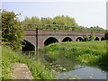

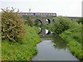
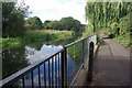
84 photos from this area
Area Information
Key information about the NN4 8SP including its size, population, and administrative classification.
- Area Type
- Postcode
- Area Size
- 1.3 hectares
- Population
- 1665
- Population Density
- 3783 people/km²
House Prices in NN4 8SP
55
Properties
£120,875
Average Sold Price
£39,000
Lowest Price
£220,000
Highest Price
Showing 55 properties
| Address | Type | Beds | Baths | Last Sale Price | Last Sale Date | |
|---|---|---|---|---|---|---|
| 17 The Briars, Northampton, NN4 8SP | Terraced | 3 | 1 | £220,000 | Aug 2024 | |
| 42 The Briars, Northampton, NN4 8SP | Retail | 3 | 1 | £210,000 | Oct 2022 | |
| 47 The Briars, Northampton, NN4 8SP | house | - | - | £192,000 | Jul 2022 | |
| 12 The Briars, Northampton, NN4 8SP | house | - | - | £166,500 | Jul 2022 | |
| 22 The Briars, Northampton, NN4 8SP | house | - | - | £185,000 | May 2022 | |
| 10 The Briars, Northampton, NN4 8SP | house | - | - | £140,000 | Sep 2020 | |
| 3 The Briars, Northampton, NN4 8SP | Terraced | 3 | 1 | £155,000 | Mar 2020 | |
| 13 The Briars, Northampton, NN4 8SP | house | 1 | 1 | £167,000 | Aug 2018 | |
| 21 The Briars, Northampton, NN4 8SP | Flat | - | - | £112,500 | Aug 2017 | |
| 25 The Briars, Northampton, NN4 8SP | Flat | - | - | £84,000 | Jan 2017 |
Page 1 of 6
Energy Efficiency in NN4 8SP
Amenities
Schools
| Rank | School | Type | Entry gender | Ages |
|---|
Explore more schools in this area
Go to Schools tabDemographics
Household Size
Family (3-5 people)
most common
Accommodation Type
Houses
most common
Tenure
32
majority
Ethnic Group
White
most common
Religion
N/A
most common
Household Composition
N/A
most common
Age
47
median
Adults (30-64 years)
most common
Household Deprivation
N/A
with no deprivation
NS-SEC
16
in Lower managerial occupations
Explore more demographic insights in this area
Go to Demographics tabPlanning
Planning Constraints
- Flood RiskPremium
- Ramsar Wetland SitesPremium
- Area of Outstanding Natural BeautyPremium
- Protected Nature ReservePremium
- Protected WoodlandPremium