Area Overview for NN4 8PP
Photos of NN4 8PP

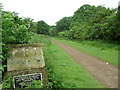
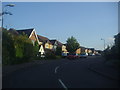
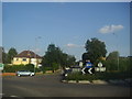
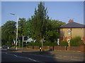
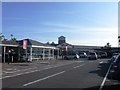

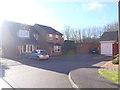
22 photos from this area
Area Information
Key information about the NN4 8PP including its size, population, and administrative classification.
- Area Type
- Postcode
- Area Size
- 2.6 hectares
- Population
- 1611
- Population Density
- 3606 people/km²
House Prices in NN4 8PP
46
Properties
£175,460
Average Sold Price
£30,000
Lowest Price
£275,000
Highest Price
Showing 46 properties
| Address | Type | Beds | Baths | Last Sale Price | Last Sale Date | |
|---|---|---|---|---|---|---|
| 49 Gloucester Crescent, Northampton, NN4 8PP | Semi-detached | 3 | 1 | £260,000 | Aug 2024 | |
| 81 Gloucester Crescent, Northampton, NN4 8PP | Semi-detached | 3 | - | £275,000 | Apr 2024 | |
| 59 Gloucester Crescent, Northampton, NN4 8PP | Semi-detached | 3 | 1 | £275,000 | Jan 2024 | |
| 91 Gloucester Crescent, Northampton, NN4 8PP | Semi-detached | 3 | 1 | £250,000 | May 2023 | |
| 19 Gloucester Crescent, Northampton, NN4 8PP | house | - | - | £255,000 | Aug 2022 | |
| 69 Gloucester Crescent, Northampton, NN4 8PP | house | - | - | £250,000 | Jul 2021 | |
| 43 Gloucester Crescent, Northampton, NN4 8PP | house | - | - | £210,000 | Mar 2021 | |
| 73 Gloucester Crescent, Northampton, NN4 8PP | Semi-detached | 3 | - | £239,000 | Nov 2020 | |
| 87 Gloucester Crescent, Northampton, NN4 8PP | house | 6 | 5 | £184,995 | Dec 2017 | |
| 9 Gloucester Crescent, Northampton, NN4 8PP | Semi-detached | 3 | - | £228,000 | Dec 2017 |
Page 1 of 5
Energy Efficiency in NN4 8PP
Amenities
Schools
| Rank | School | Type | Entry gender | Ages |
|---|
Explore more schools in this area
Go to Schools tabDemographics
Household Size
Family (3-5 people)
most common
Accommodation Type
Houses
most common
Tenure
41
majority
Ethnic Group
White
most common
Religion
N/A
most common
Household Composition
N/A
most common
Age
47
median
Adults (30-64 years)
most common
Household Deprivation
N/A
with no deprivation
NS-SEC
17
in Lower managerial occupations
Explore more demographic insights in this area
Go to Demographics tabPlanning
Planning Constraints
- Flood RiskPremium
- Ramsar Wetland SitesPremium
- Area of Outstanding Natural BeautyPremium
- Protected Nature ReservePremium
- Protected WoodlandPremium