Area Overview for NN4 8ED
Photos of NN4 8ED
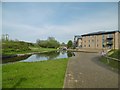
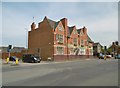
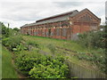
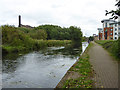
100 photos from this area
Area Information
Key information about the NN4 8ED including its size, population, and administrative classification.
- Area Type
- Postcode
- Area Size
- 1.0 hectares
- Population
- 1587
- Population Density
- 3869 people/km²
House Prices in NN4 8ED
50
Properties
£144,255
Average Sold Price
£34,000
Lowest Price
£243,000
Highest Price
Showing 50 properties
| Address | Type | Beds | Baths | Last Sale Price | Last Sale Date | |
|---|---|---|---|---|---|---|
| 72 Penrhyn Road, Northampton, NN4 8ED | Terraced | 3 | 1 | £197,000 | Feb 2025 | |
| 42 Penrhyn Road, Northampton, NN4 8ED | Semi-detached | 3 | 1 | £190,000 | Aug 2024 | |
| 96 Penrhyn Road, Northampton, NN4 8ED | Terraced | 3 | 1 | £237,000 | May 2024 | |
| 114 Penrhyn Road, Northampton, NN4 8ED | house | 3 | 1 | £220,000 | Aug 2023 | |
| 60 Penrhyn Road, Northampton, NN4 8ED | Retail | 3 | 1 | £240,000 | Sep 2022 | |
| 120 Penrhyn Road, Northampton, NN4 8ED | Terraced | 3 | 2 | £243,000 | Aug 2022 | |
| 108 Penrhyn Road, Northampton, NN4 8ED | Retail | 3 | 1 | £215,000 | Jun 2022 | |
| 48 Penrhyn Road, Northampton, NN4 8ED | Terraced | 3 | - | £235,000 | Nov 2021 | |
| 68 Penrhyn Road, Northampton, NN4 8ED | Terraced | 3 | 1 | £230,000 | Aug 2021 | |
| 130 Penrhyn Road, Northampton, NN4 8ED | house | - | - | £225,000 | Jun 2021 |
Page 1 of 5
Energy Efficiency in NN4 8ED
Amenities
Schools
| Rank | School | Type | Entry gender | Ages |
|---|
Explore more schools in this area
Go to Schools tabDemographics
Household Size
Family (3-5 people)
most common
Accommodation Type
Houses
most common
Tenure
57
majority
Ethnic Group
White
most common
Religion
N/A
most common
Household Composition
N/A
most common
Age
47
median
Adults (30-64 years)
most common
Household Deprivation
N/A
with no deprivation
NS-SEC
21
in Lower managerial occupations
Explore more demographic insights in this area
Go to Demographics tabPlanning
Planning Constraints
- Flood RiskPremium
- Ramsar Wetland SitesPremium
- Area of Outstanding Natural BeautyPremium
- Protected Nature ReservePremium
- Protected WoodlandPremium