Area Overview for NN4 6RP
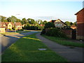
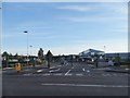
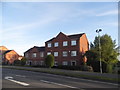
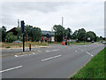
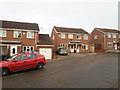
Photos of NN4 6RP


Area Information
Living in NN4 6RP means being part of a tightly knit residential cluster in England, where 1805 people reside across just 6338 square metres. This compact area is characterised by a high population density of 284,795 people per square kilometre, reflecting its small-scale, community-focused nature. The area is predominantly home to adults aged 30–64, with a median age of 47, suggesting a mature, stable population. Daily life here is shaped by proximity to essential services, including a primary school with a good Ofsted rating and retail outlets like Waitrose Wootton and Tesco East. The mix of houses, with 74% owner-occupied properties, points to a settled community. Residents benefit from nearby transport links, including Northampton Railway Station and two bus interchanges, while digital connectivity is near flawless, with a broadband score of 100. NN4 6RP is ideal for those seeking a balance between convenience and a low-crime environment, though its size means it is best suited to those prioritising proximity to amenities over expansive living space.
- Area Type
- Postcode
- Area Size
- 6338 m²
- Population
- 1805
- Population Density
- 4429 people/km²
The property market in NN4 6RP is dominated by owner-occupied homes, with 74% of properties held by residents rather than landlords. This suggests a community where long-term residency is common, and properties are likely to be well-maintained. The accommodation type is primarily houses, which contrasts with areas where flats or apartments predominate. Given the area’s small size—just 6338 square metres—the housing stock is limited, making it a niche market for buyers seeking a specific location. The high population density of 284,795 people per square kilometre further indicates that properties are closely spaced, with little scope for new developments. For buyers, this means competition for available homes, though the proximity to amenities like Wootton Primary School and Northampton Railway Station may offset the compact nature of the area. The focus on houses also implies that properties are likely to be family-friendly, with space and layout suited to settled households.
House Prices in NN4 6RP
Showing 17 properties
| Address | Type | Beds | Baths | Last Sale Price | Last Sale Date | |
|---|---|---|---|---|---|---|
| 10 Battle Close, Northampton, NN4 6RP | Detached | 4 | 1 | £383,000 | Mar 2025 | |
| 17 Battle Close, Northampton, NN4 6RP | Detached | 4 | 2 | £356,000 | Mar 2024 | |
| 15 Battle Close, Northampton, NN4 6RP | Retail | 4 | 2 | £420,000 | Mar 2022 | |
| 3 Battle Close, Northampton, NN4 6RP | house | - | - | £280,000 | Dec 2016 | |
| 7 Battle Close, Northampton, NN4 6RP | Semi-detached | 3 | 2 | £167,500 | May 2013 | |
| 16 Battle Close, Northampton, NN4 6RP | house | 4 | 2 | £210,000 | Nov 2012 | |
| 2 Battle Close, Northampton, NN4 6RP | house | - | - | £275,000 | Dec 2009 | |
| 9 Battle Close, Northampton, NN4 6RP | house | - | - | £173,500 | Oct 2008 | |
| 8 Battle Close, Northampton, NN4 6RP | Detached | - | - | £237,500 | Nov 2007 | |
| 5 Battle Close, Northampton, NN4 6RP | house | - | - | £181,000 | Apr 2007 |
Energy Efficiency in NN4 6RP
Life in NN4 6RP is shaped by its proximity to essential amenities, including retail outlets like Waitrose Wootton, Tesco East, and Co-op Wootten. These shops provide daily necessities, reducing the need for long trips. The area’s transport links, such as Northampton Railway Station and two bus interchanges, offer easy access to nearby towns and educational institutions. While there are no parks or leisure facilities listed, the compact nature of the area means residents can reach larger recreational spaces in nearby towns. The presence of Wootton Primary School adds to the community feel, with families able to access education and social hubs locally. The combination of retail, transport, and schools creates a convenient lifestyle, though the small size of the area means residents may seek additional leisure options beyond NN4 6RP.
Amenities
Schools
The nearest school to NN4 6RP is Wootton Primary School, which serves the local community with a good Ofsted rating. This primary school is a key asset for families, providing education for younger children within easy reach. The presence of a single primary school suggests that the area is well-served for early education but lacks secondary schools nearby, which may require residents to commute for older children. The school’s rating indicates a satisfactory standard of teaching and facilities, though parents should consider the absence of secondary options when planning for long-term family needs. For those prioritising proximity to schools, Wootton Primary School is a strong point in favour of NN4 6RP, but the lack of a broader range of educational institutions may be a consideration for larger families.
| Rank | School | Type | Entry gender | Ages |
|---|
Explore more schools in this area
Go to Schools tabDemographics
The community in NN4 6RP is predominantly composed of adults aged 30–64, with a median age of 47. This age profile suggests a population focused on established careers and family life. Home ownership is high, with 74% of properties owner-occupied, indicating a stable, long-term resident base. The area is largely composed of houses, reflecting a preference for single-family dwellings over flats. The predominant ethnic group is White, with no specific data provided on other demographics. The population density of 284,795 people per square kilometre is exceptionally high, underscoring the area’s compact nature. This density, combined with the age range and ownership figures, points to a community that is both mature and tightly knit, with limited scope for expansion. For buyers, this means a market where properties are likely to be well-maintained and in demand, though the small size of the area may limit availability.
Household Size
Accommodation Type
Tenure
Ethnic Group
Religion
Household Composition
Age
Household Deprivation
NS-SEC
Explore more demographic insights in this area
Go to Demographics tabPlanning
Planning Constraints
- Flood RiskPremium
- Ramsar Wetland SitesPremium
- Area of Outstanding Natural BeautyPremium
- Protected Nature ReservePremium
- Protected WoodlandPremium