Area Overview for NN4 6JW
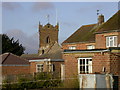
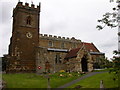
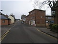
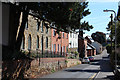
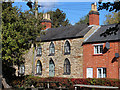
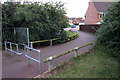
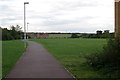
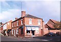
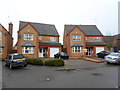
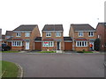
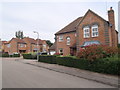
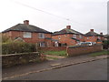
Photos of NN4 6JW
Area Information
NN4 6JW is a compact residential cluster in England, spanning just 2.3 hectares and home to 2,233 residents. Its high population density of 95,803 people per square kilometre reflects a tightly knit community, where daily life is shaped by proximity to essential services. The area’s small size means residents are likely to know their neighbours, fostering a sense of familiarity. With a median age of 47 and a strong presence of adults aged 30–64, the population skews towards families and established professionals. The area’s appeal lies in its balance of residential tranquillity and practical access to amenities, such as retail outlets like Co-op Wootten and Waitrose Wootton, and transport links including Northampton Railway Station. While the postcode covers a limited geographical footprint, its connectivity to nearby hubs like Northampton Bus Interchange ensures residents can easily access broader opportunities. The absence of environmental constraints like AONB or protected woodlands means development is not restricted, though the area’s safety profile—low crime risk and no flood hazards—adds to its appeal for homebuyers seeking stability.
- Area Type
- Postcode
- Area Size
- 2.3 hectares
- Population
- 2233
- Population Density
- 5046 people/km²
The property market in NN4 6JW is characterised by high home ownership (81%) and a predominance of houses, indicating a focus on owner-occupied, family-friendly housing. This suggests the area is not a rental hotspot but rather a place where residents are likely to have long-term ties. The compact nature of the postcode—covering just 2.3 hectares—means the housing stock is limited, with little scope for new developments. Buyers should consider nearby areas for more options, though the existing properties are likely to be well-established. The absence of planning constraints like AONB or protected woodlands means the area is not restricted in terms of housing flexibility. However, the small size means competition for properties could be intense, especially for families seeking larger homes. The emphasis on houses over flats may appeal to those prioritising space and privacy, though buyers should evaluate whether the immediate surroundings offer additional housing diversity.
House Prices in NN4 6JW
Showing 31 properties
| Address | Type | Beds | Baths | Last Sale Price | Last Sale Date | |
|---|---|---|---|---|---|---|
| 10 Spartan Close, Northampton, NN4 6JW | Detached | 4 | 2 | £570,000 | Jun 2025 | |
| 23 Spartan Close, Northampton, NN4 6JW | Detached | 4 | 2 | £465,000 | Jan 2025 | |
| 26 Spartan Close, Northampton, NN4 6JW | Detached | 4 | 3 | £370,000 | Sep 2019 | |
| 24 Spartan Close, Northampton, NN4 6JW | house | 4 | - | £358,000 | Jul 2019 | |
| 14 Spartan Close, Northampton, NN4 6JW | Detached | 6 | - | £465,000 | May 2016 | |
| 12 Spartan Close, Northampton, NN4 6JW | house | - | - | £345,000 | Jan 2012 | |
| 29 Spartan Close, Northampton, NN4 6JW | house | 4 | - | £250,000 | Feb 2011 | |
| 32 Spartan Close, Northampton, NN4 6JW | Detached | - | - | £425,000 | Jun 2007 | |
| 1 Spartan Close, Northampton, NN4 6JW | Detached | - | - | £333,000 | Dec 2006 | |
| 2 Spartan Close, Northampton, NN4 6JW | Detached | - | - | £381,000 | Apr 2006 |
Energy Efficiency in NN4 6JW
Daily life in NN4 6JW is shaped by its proximity to essential amenities, including five retail outlets such as Co-op Wootten, Co-op Grange, and Waitrose Wootton. These provide a range of shopping options, from everyday essentials to more specialised retail. The area’s transport links, including Northampton Railway Station and two bus interchanges, ensure easy access to dining, leisure, and cultural opportunities in nearby towns. While the data does not specify parks or recreational spaces, the absence of environmental constraints like AONB or protected woodlands suggests the area is not restricted in terms of outdoor activities. The compact nature of the postcode means residents are likely to rely on nearby hubs for larger leisure facilities, though the immediate vicinity offers sufficient convenience for daily needs. The combination of retail access and transport connectivity makes NN4 6JW a practical choice for those prioritising ease of living.
Amenities
Schools
The nearest school to NN4 6JW is Preston Hedges Primary School, which has an Ofsted rating of outstanding. This indicates a high standard of education for younger children, though the data does not mention secondary schools or other educational institutions. The presence of a primary school with an outstanding rating is a significant draw for families, as it suggests a strong foundation for early education. The school’s proximity to the area ensures ease of access for parents and students, reducing reliance on longer commutes. However, the absence of secondary school data means families may need to consider additional travel for older children. The single primary school in the area reflects a focus on local education, but buyers should verify whether the school’s capacity meets the needs of growing families.
| Rank | School | Type | Entry gender | Ages |
|---|
Explore more schools in this area
Go to Schools tabDemographics
The community in NN4 6JW is predominantly composed of adults aged 30–64, with a median age of 47. This suggests a mature population, likely centred around families and long-term residents. Home ownership is high, at 81%, indicating a stable housing market with a focus on private residences rather than rentals. The area’s accommodation is primarily houses, reflecting a preference for standalone properties over flats. The predominant ethnic group is White, with no specific data on other demographics provided. The high home ownership rate and age profile suggest a community prioritising security and long-term living. While no deprivation data is available, the absence of environmental or planning constraints implies a relatively straightforward quality of life, with minimal barriers to housing or development. The age group’s presence also aligns with school-age children, supported by local primary education options.
Household Size
Accommodation Type
Tenure
Ethnic Group
Religion
Household Composition
Age
Household Deprivation
NS-SEC
Explore more demographic insights in this area
Go to Demographics tabPlanning
Planning Constraints
- Flood RiskPremium
- Ramsar Wetland SitesPremium
- Area of Outstanding Natural BeautyPremium
- Protected Nature ReservePremium
- Protected WoodlandPremium