Area Overview for NN4 6JB
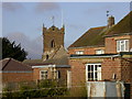
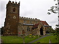
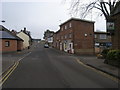
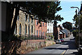
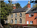
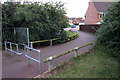
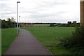
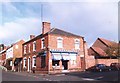
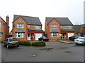
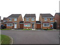
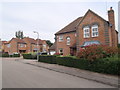
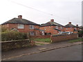
Photos of NN4 6JB
Area Information
NN4 6JB is a compact residential postcode in England, covering 9,134 square metres and home to 1,898 residents. Its high population density of 207,802 people per square kilometre reflects its small, tightly knit character. This area is defined by its proximity to essential services and transport links, making it practical for daily living. The community is predominantly composed of adults aged 30–64, with a median age of 47, suggesting a stable, mature demographic. While the area lacks natural features like protected woodlands or wetlands, its urban setting is complemented by accessible amenities. Residents benefit from excellent broadband connectivity, scoring 100, and reliable mobile coverage. The area’s compact size means most needs are within walking or short driving distance, though its limited size also means housing options are constrained. For those prioritising convenience over sprawling landscapes, NN4 6JB offers a focused, functional environment.
- Area Type
- Postcode
- Area Size
- 9134 m²
- Population
- 1898
- Population Density
- 3185 people/km²
The property market in NN4 6JB is dominated by owner-occupied homes, with 85% of residents living in properties they own. The accommodation type is primarily houses, which is unusual for a small postcode area but suggests a focus on family-sized or semi-detached housing. This contrasts with areas where flats or rental properties dominate. The limited size of NN4 6JB means the housing stock is constrained, and buyers should consider proximity to nearby amenities and transport links as key factors. The high home ownership rate indicates a stable market with long-term residents, but the small area size may limit availability for new buyers. Those seeking a home here should prioritise properties with access to nearby retail, transport, and services, as these are central to the area’s appeal.
House Prices in NN4 6JB
Showing 22 properties
| Address | Type | Beds | Baths | Last Sale Price | Last Sale Date | |
|---|---|---|---|---|---|---|
| 26 Walkers Way, Northampton, NN4 6JB | Detached | 4 | 2 | £562,500 | Oct 2025 | |
| 42 Walkers Way, Northampton, NN4 6JB | Detached | 4 | 3 | £410,000 | Aug 2024 | |
| 44 Walkers Way, Northampton, NN4 6JB | Retail | 4 | 2 | £465,000 | Dec 2022 | |
| 24 Walkers Way, Northampton, NN4 6JB | Detached | 4 | 2 | £495,000 | Mar 2022 | |
| 20 Walkers Way, Northampton, NN4 6JB | house | - | - | £340,000 | Dec 2021 | |
| 12 Walkers Way, Northampton, NN4 6JB | Detached | 4 | - | £360,000 | Mar 2017 | |
| 2 Walkers Way, Northampton, NN4 6JB | Detached | 4 | 2 | £380,000 | Feb 2017 | |
| 32 Walkers Way, Northampton, NN4 6JB | Detached | 4 | 2 | £275,000 | Sep 2016 | |
| 34 Walkers Way, Northampton, NN4 6JB | Detached | 3 | 2 | £258,000 | Jun 2016 | |
| 38 Walkers Way, Northampton, NN4 6JB | Detached | 4 | 2 | £250,000 | Oct 2014 |
Energy Efficiency in NN4 6JB
Living in NN4 6JB offers access to essential retail and transport hubs within practical reach. Nearby shops include Co-op Wootten, Co-op Grange, and Tesco East, providing grocery and daily essentials. The Northampton Bus Interchange and University Bus Interchange offer frequent services, linking residents to Northampton Railway Station and surrounding areas. While the area lacks dedicated parks or leisure facilities, its compact design ensures amenities are close. The presence of multiple retail outlets and transport options contributes to a convenient, functional lifestyle. For those prioritising accessibility over expansive green spaces, NN4 6JB’s proximity to services and connectivity makes it practical for daily routines. The character of the area is defined by its focus on utility, with limited emphasis on recreational spaces.
Amenities
Schools
| Rank | School | Type | Entry gender | Ages |
|---|
Explore more schools in this area
Go to Schools tabDemographics
The population of NN4 6JB is 1,898, with a median age of 47. The majority of residents fall within the 30–64 age range, indicating a mature, established community. Home ownership is high, at 85%, with most properties being houses rather than flats. The predominant ethnic group is White, and the area’s demographic profile suggests a relatively homogeneous population. The high population density—207,802 people per square kilometre—reflects the area’s small size and concentrated housing. While this density may imply limited green space, it also means amenities are closely clustered. The age profile and ownership rates suggest a community with long-term residents and a focus on stability. However, the lack of diversity data means broader social dynamics are not detailed in the available information.
Household Size
Accommodation Type
Tenure
Ethnic Group
Religion
Household Composition
Age
Household Deprivation
NS-SEC
Explore more demographic insights in this area
Go to Demographics tabPlanning
Planning Constraints
- Flood RiskPremium
- Ramsar Wetland SitesPremium
- Area of Outstanding Natural BeautyPremium
- Protected Nature ReservePremium
- Protected WoodlandPremium