Area Overview for NN4 6FL
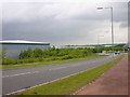
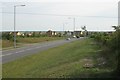
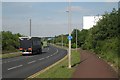
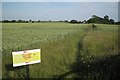
Photos of NN4 6FL


Area Information
Living in NN4 6FL means being part of a small, tightly knit residential cluster in England. The area covers 4,507 square metres and is home to 1,590 people, giving it a population density of 184 people per square kilometre. This compact postcode is characterised by its quiet, residential nature, with a focus on private homes rather than high-density housing. Daily life here is shaped by proximity to essential services and a mix of local amenities. The area’s modest size means it is likely to feel familiar to residents, with a sense of community reinforced by its limited footprint. While not a major urban centre, NN4 6FL benefits from connectivity to nearby transport hubs, including Northampton Railway Station and multiple bus routes. Its appeal lies in its balance of seclusion and accessibility, making it suitable for those seeking a stable, low-maintenance environment without sacrificing practicality. The area’s demographics suggest a mature population, with a median age of 47, indicating a community that values stability and established living.
- Area Type
- Postcode
- Area Size
- 4507 m²
- Population
- 1590
- Population Density
- 184 people/km²
The property market in NN4 6FL is dominated by owner-occupied homes, with 73% of residents owning their properties. This high rate of home ownership suggests a community focused on long-term residency rather than rental turnover. The area is primarily composed of houses, which contrasts with regions where flats or apartments predominate. This housing type aligns with the demographic profile of older, established households, many of whom may have lived in the area for years. The limited size of the postcode—just 4,507 square metres—means the housing stock is concentrated, with no indication of large-scale development or new builds. For buyers, this implies a market with limited inventory but potentially stable values, as the area is not subject to rapid change. The absence of rental properties or student housing further reinforces the notion of a mature, settled community. Prospective buyers should consider the small area size when evaluating proximity to amenities, as the immediate surroundings may offer more options than the postcode itself.
House Prices in NN4 6FL
Showing 12 properties
| Address | Type | Beds | Baths | Last Sale Price | Last Sale Date | |
|---|---|---|---|---|---|---|
| 6 Wayfaring Road, Northampton, NN4 6FL | house | - | - | £314,000 | Dec 2024 | |
| 3 Wayfaring Road, Northampton, NN4 6FL | house | - | - | - | - | |
| 4 Wayfaring Road, Northampton, NN4 6FL | house | - | - | - | - | |
| 7 Wayfaring Road, Northampton, NN4 6FL | house | - | - | - | - | |
| 14 Wayfaring Road, Northampton, NN4 6FL | house | - | - | - | - | |
| 9 Wayfaring Road, Northampton, NN4 6FL | house | - | - | - | - | |
| 2 Wayfaring Road, Northampton, NN4 6FL | house | - | - | - | - | |
| 8 Wayfaring Road, Northampton, NN4 6FL | house | - | - | - | - | |
| 12 Wayfaring Road, Northampton, NN4 6FL | house | - | - | - | - | |
| 5 Wayfaring Road, Northampton, NN4 6FL | house | - | - | - | - |
Energy Efficiency in NN4 6FL
Residents of NN4 6FL have access to a range of local amenities within practical reach. The area includes five retail outlets, such as Co-op Wootten, Waitrose Wootton, and Tesco East, offering everyday shopping needs. These stores suggest a mix of local and larger supermarket chains, providing convenience for households. Public transport options include two bus routes and a railway station at Northampton, facilitating travel to nearby towns and cities. While the area does not list parks or leisure facilities in the data, its proximity to transport hubs implies access to broader recreational opportunities beyond the immediate postcode. The presence of a nearby independent school also indicates that families may prioritise educational amenities in their lifestyle choices. The combination of retail, transport, and educational services creates a functional, low-maintenance lifestyle, ideal for those seeking a balance between local convenience and regional connectivity.
Amenities
Schools
The nearest school to NN4 6FL is Great Houghton School, an independent institution. No Ofsted rating is provided in the data, but the presence of an independent school suggests a focus on private education for families in the area. Independent schools often cater to specific educational philosophies or specialisms, though the exact curriculum or facilities are not detailed here. For families prioritising private schooling, this school may be a key factor in deciding to live in NN4 6FL. However, the absence of state schools or other educational institutions within the data means that parents may need to look beyond the immediate area for public schooling options. The single listed school indicates a limited choice in educational settings, which could be a consideration for those requiring diverse or multiple school options for their children.
| Rank | School | Type | Entry gender | Ages |
|---|
Explore more schools in this area
Go to Schools tabDemographics
The community in NN4 6FL is predominantly composed of adults aged 30–64, with a median age of 47. This suggests a population that is largely in their prime working years or nearing retirement. Home ownership is high, with 73% of residents owning their properties, reflecting a preference for long-term stability. The area is characterised by houses rather than flats or apartments, aligning with the demographic profile of older, established households. The predominant ethnic group is White, though no further breakdown of diversity is provided. The population density of 184 people per square kilometre indicates a low-rise, spread-out residential layout rather than a densely packed urban environment. This density level supports a quiet, less congested lifestyle, which may appeal to those prioritising privacy over proximity to city centres. The absence of specific data on deprivation means that quality of life is inferred from the area’s low risk assessments and stable housing stock.
Household Size
Accommodation Type
Tenure
Ethnic Group
Religion
Household Composition
Age
Household Deprivation
NS-SEC
Explore more demographic insights in this area
Go to Demographics tabPlanning
Planning Constraints
- Flood RiskPremium
- Ramsar Wetland SitesPremium
- Area of Outstanding Natural BeautyPremium
- Protected Nature ReservePremium
- Protected WoodlandPremium